Ith - Ithwiesen
Airport details
| Country | Germany |
| State | Lower Saxony |
| Region | ED |
| Airspace | Bremen Ctr |
| Municipality | Holzen |
| Elevation | 1227ft (374m) |
| Timezone | GMT +1 |
| Coordinates | 51.95133, 9.66217 |
| Magnetic var | |
| Type | land |
| Available since | X-Plane v10.40 |
| ICAO code | EDVT |
| IATA code | n/a |
| FAA code | n/a |
Communication
| Ithwiesen Ithwiesen Info | 130.655 |
Nearby Points of Interest:
St. Jakobus (Eime)
-Kirche Mariä Geburt
-St. Georg
-Hajener Hungerstein
-Saint Martin Church
-St. Laurentius
-Jewish cemetery, Dassel
-Rittergut Voldagsen
-Burg Hausfreden
-Kornhaus
-Jewish Cemetery, Sievershausen
-Einbeck Municipal Museum
-Tiedexer Straße
-St. Trinitatiskirche
-Clarissenkloster (Einbeck)
-Alte Synagoge
-Antoniuskirche
-St. Martinskirche (Greene, Lower Saxony)
-St. Mauritius (Almstedt)
-Schloss Hasperde
-Dreizehnlinden-Kreuz
-Ringwall der Marienburg bei Nordstemmen
-Dreizehnlindenhaus
-St. Vinzenz
-Gandersheim Abbey
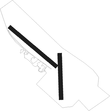
Runway info
Runway 14 / 32  | ||
| length | 494m (1621ft) | |
| bearing | 121° / 301° | |
| width | 33m (108ft) | |
| surface | grass | |
| Runway 18 / 36 | ||
| length | 359m (1178ft) | |
| bearing | 184° / 4° | |
| width | 35m (115ft) | |
| surface | grass | |
Nearby beacons
| code | identifier | dist | bearing | frequency |
|---|---|---|---|---|
| DLE | LEINE VOR/DME | 19.7 | 37° | 115.20 |
| SAS | SARSTEDT VOR/DME | 19.7 | 37° | 114.45 |
| BYC | BUECKEBURG NDB | 29.3 | 301° | 368 |
| HBD | DME | 30.2 | 360° | 116.90 |
| HAD | DME | 31 | 4° | 113.95 |
| HA | HANNOVER NDB | 31.2 | 16° | 320 |
| HW | HANNOVER NDB | 31.3 | 347° | 358 |
| WUN | WUNSTORF TACAN | 31.4 | 335° | 114.85 |
| DKS | DME-ILS | 33.2 | 206° | 111.50 |
| WRB | WARBURG VOR/DME | 33.7 | 231° | 113.70 |
| CEL | CELLE NDB | 40.6 | 30° | 311 |
| BRU | BRAUNSCHWEIG-WOLFSBURG NDB | 41.3 | 69° | 427 |
| NIE | NIENBURG VOR | 41.8 | 337° | 116.50 |
| FTZ | FRITZLAR NDB | 52.8 | 196° | 468 |
| FSB | FASSBERG NDB | 61 | 29° | 284 |
Disclaimer
The information on this website is not for real aviation. Use this data with the X-Plane flight simulator only! Data taken with kind consent from X-Plane 12 source code and data files. Content is subject to change without notice.