Bad Pyrmont - Hameln- Bad Pyrmont
Airport details
| Country | Germany |
| State | Lower Saxony |
| Region | ED |
| Airspace | Bremen Ctr |
| Municipality | Bad Pyrmont |
| Elevation | 1141ft (348m) |
| Timezone | GMT +1 |
| Coordinates | 51.96750, 9.29300 |
| Magnetic var | |
| Type | land |
| Available since | X-Plane v10.40 |
| ICAO code | EDVW |
| IATA code | n/a |
| FAA code | n/a |
Communication
| Hameln- Bad Pyrmont Pyrmont Info | 121.175 |
Nearby Points of Interest:
Hünenburg
-Hajener Hungerstein
-Rathaus Blomberg
-Synagoge (Blomberg)
-Gut Grevenburg
-Osterstraße 12
-St. Jakobus d. Ä. und Christophorus
-Jewish cemetery, Vörden, Marienmünster
-Bauernburg Ottenhausen
-Obermühle
-Rathaus Nieheim
-Amtsgericht Höxter
-Dreizehnlinden-Kreuz
-Adelshof Heisterman von Ziehlberg
-Rathaus Höxter
-Dreizehnlindenhaus
-Schloss Hasperde
-house with mikwe
-Felsenkeller (Höxter)
-Steinkuhlenstraße 30 (Detmold)
-Rittergut Voldagsen
-Amtsgericht Horn
-Mariä Himmelfahrt
-Schloss Brake
-St. Vinzenz
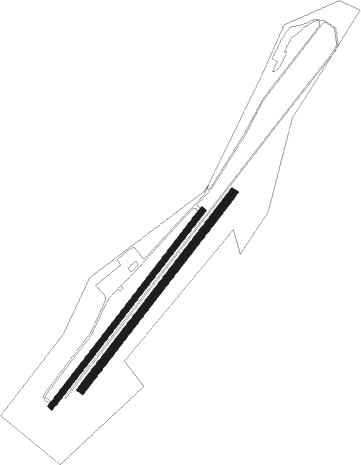
Runway info
Runway 04 / 22  | ||
| length | 616m (2021ft) | |
| bearing | 56° / 236° | |
| width | 15m (49ft) | |
| surface | asphalt | |
| displ threshold | 7m (23ft) / 10m (33ft) | |
| Runway 04R / 22L | ||
| length | 617m (2024ft) | |
| bearing | 56° / 236° | |
| width | 20m (66ft) | |
| surface | grass | |
Nearby beacons
| code | identifier | dist | bearing | frequency |
|---|---|---|---|---|
| BYC | BUECKEBURG NDB | 20.8 | 328° | 368 |
| DLE | LEINE VOR/DME | 27.6 | 64° | 115.20 |
| SAS | SARSTEDT VOR/DME | 27.6 | 64° | 114.45 |
| WRB | WARBURG VOR/DME | 28.5 | 202° | 113.70 |
| WUN | WUNSTORF TACAN | 29.6 | 16° | 114.85 |
| HW | HANNOVER NDB | 31.5 | 27° | 358 |
| PAD | PADERBORN-LIPPSTADT NDB | 31.8 | 242° | 354 |
| HBD | DME | 32.2 | 37° | 116.90 |
| PAD | DME-ILS | 32.9 | 242° | 108.50 |
| DKS | DME-ILS | 33 | 168° | 111.50 |
| HAD | DME | 33.5 | 39° | 113.95 |
| HA | HANNOVER NDB | 35.2 | 46° | 320 |
| NIE | NIENBURG VOR | 39.6 | 7° | 116.50 |
| CEL | CELLE NDB | 46.1 | 50° | 311 |
| DP | DIEPHOLZ NDB | 48.5 | 307° | 325 |
| FTZ | FRITZLAR NDB | 53.2 | 172° | 468 |
| FSB | FASSBERG NDB | 65.6 | 43° | 284 |
Disclaimer
The information on this website is not for real aviation. Use this data with the X-Plane flight simulator only! Data taken with kind consent from X-Plane 12 source code and data files. Content is subject to change without notice.