Bremerhaven - Bremerhaven-luneort (clsd)
Airport details
| Country | Germany |
| State | Free Hanseatic City of Bremen |
| Region | ED |
| Airspace | Bremen Ctr |
| Municipality | Bremerhaven |
| Elevation | 7ft (2m) |
| Timezone | GMT +1 |
| Coordinates | 53.50708, 8.57288 |
| Magnetic var | |
| Type | land |
| Available since | X-Plane v10.40 |
| ICAO code | EDWB |
| IATA code | BRV |
| FAA code | n/a |
Communication
Nearby Points of Interest:
Villa Busse
-Wohnwasserturm Wulsdorf
-Bauernhaus Allersstraße 27
-Reichspostamt Geestemünde
-Hauptzollamt Geestemünde
-Haus Schuchmann
-Wohnhaus Berliner Platz 11
-Christuskirche (Bremerhaven-Geestemünde)
-Wasserstandsanzeiger Bremerhaven
-Zollhaus
-Seute Deern
-Wohnhausgruppe An der Karlstadt 29
-Wohnhaus Deichstraße 38
-Norddeutsche Volksstimme
-Hafenamt
-Bürgermeister-Smidt-Straße 120
-Wohnanlage und Ladenzeile Lloydstraße18
-Seemannsamt
-Villa Rabien
-Villa Seedorf
-Haus Rahusen
-Allgemeine Ortskrankenkasse Bremerhaven
-Haus des Handwerks
-Rudelsburg
-Hafenstraße 42
Runway info
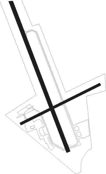
Runway 16 / 34  | ||
| length | 1206m (3957ft) | |
| bearing | 154° / 334° | |
| width | 30m (98ft) | |
| surface | asphalt | |
| displ threshold | 0m (0ft) / 85m (279ft) | |
| blast zone | 60m (197ft) / 95m (312ft) | |
| Runway 07 / 25 | ||
| length | 656m (2152ft) | |
| bearing | 76° / 256° | |
| width | 19m (62ft) | |
| surface | asphalt | |
| displ threshold | 35m (115ft) / 50m (164ft) | |
| blast zone | 27m (89ft) / 0m (0ft) | |
Nearby beacons
| code | identifier | dist | bearing | frequency |
|---|---|---|---|---|
| WSN | WESER NDB | 14.4 | 118° | 378 |
| NDO | NORDHOLZ TACAN | 15.9 | 17° | 117.10 |
| NDO | NORDHOLZ NDB | 18.6 | 40° | 372 |
| BMN | BREMEN VOR/DME | 28.4 | 158° | 117.45 |
| BND | DME | 28.8 | 156° | 113.65 |
| HIG | BREMEN NDB | 30 | 144° | 318 |
| WTM | WITTMUNDHAFEN TACAN | 30.3 | 273° | 113.50 |
| DHE | HELGOLAND VOR/DME | 47 | 316° | 116.30 |
| DP | DIEPHOLZ NDB | 55.1 | 187° | 325 |
| HNT | HOHN TACAN | 59.1 | 50° | 115.30 |
| NIE | NIENBURG VOR | 60.2 | 138° | 116.50 |
| SWG | SCHLESWIG TACAN | 66.4 | 45° | 111.80 |
Disclaimer
The information on this website is not for real aviation. Use this data with the X-Plane flight simulator only! Data taken with kind consent from X-Plane 12 source code and data files. Content is subject to change without notice.