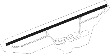
Emden
Airport details
| Country | Germany |
| State | Lower Saxony |
| Region | ED |
| Airspace | Bremen Ctr |
| Municipality | Emden |
| Elevation | 0ft (0m) |
| Timezone | GMT +1 |
| Coordinates | 53.38971, 7.22697 |
| Magnetic var | |
| Type | land |
| Available since | X-Plane v10.40 |
| ICAO code | EDWE |
| IATA code | EME |
| FAA code | n/a |
Communication
| Emden EMDEN INFO | 118.600 |
| Emden WITTMUND RADAR | 123.600 |
| Emden BREMEN RADAR | 124.800 |
Nearby beacons
| code | identifier | dist | bearing | frequency |
|---|---|---|---|---|
| WTM | WITTMUNDHAFEN TACAN | 20.3 | 72° | 113.50 |
| EEL | EELDE (GRONINGEN) VOR/DME | 24.2 | 248° | 112.40 |
| DHE | HELGOLAND VOR/DME | 53.6 | 41° | 116.30 |
Departure and arrival routes
| Transition altitude | 5000ft |
| SID end points | distance | outbound heading | |
|---|---|---|---|
| RW07 | |||
| EMPI3P | 13mi | 120° | |
| RW25 | |||
| EMPI2G | 13mi | 120° | |
Instrument approach procedures
| runway | airway (heading) | route (dist, bearing) |
|---|---|---|
| RW07-Z | EMPIT (300°) | EMPIT 4000ft WE221 (10mi, 299°) 3000ft WE222 (9mi, 299°) 2000ft WE223 (5mi, 259°) 2000ft WE224 (5mi, 152°) 1500ft |
| RNAV | WE224 1500ft DOKUV (3mi, 79°) 1500ft EDWE (5mi, 80°) 42ft WE225 (6mi, 79°) 410ft WE226 (3mi, 284°) WE227 (8mi, 138°) 3000ft EMPIT (6mi, 138°) 4000ft | |
| RW25-Z | EMPIT (300°) | EMPIT 4000ft WE121 (7mi, 0°) 3000ft WE122 (5mi, 333°) 1500ft |
| RNAV | WE122 1500ft ARKUL (3mi, 260°) 1500ft EDWE (5mi, 259°) 42ft WE123 (3mi, 261°) 410ft WE124 (4mi, 25°) WE125 (10mi, 124°) 3000ft EMPIT (6mi, 124°) 4000ft |
Disclaimer
The information on this website is not for real aviation. Use this data with the X-Plane flight simulator only! Data taken with kind consent from X-Plane 12 source code and data files. Content is subject to change without notice.
