Wiefelstede - Wiefelstede- Conneforde
Airport details
| Country | Germany |
| State | Lower Saxony |
| Region | ED |
| Airspace | Bremen Ctr |
| Municipality | Wiefelstede |
| Elevation | 28ft (9m) |
| Timezone | GMT +1 |
| Coordinates | 53.32139, 8.07361 |
| Magnetic var | |
| Type | land |
| Available since | X-Plane v10.40 |
| ICAO code | EDWP |
| IATA code | n/a |
| FAA code | n/a |
Communication
| Wiefelstede- Conneforde Conneforde Info | 126.500 |
Nearby Points of Interest:
Woltzetener Kirche
-Mansinger Burgplatz
-Lutherische Kirche
-Strandhalle Wilhelmshaven
-Bavariahaus
-St. Jakobikirche
-St. Stephanuskirche
-St. Cosmas und Damian (Barßel)
-Holy Cross Church
-Ostgroßefehner Kirche
-Liudgerikirche
-St. Florian
-Kirche Farge
-Marienkirche Warfleth
-Holtrop Church
-Haus Kapitän Dallmann
-Rathaus Blumenthal
-Amtsgericht Bremen-Blumenthal
-Wätjens Schloss
-Logabirumer Kirche
-Werkswohnanlage des Bremer Vulkan
-Brunnensäule Fröbelstraße
-Ulrichssches Wohnhaus
-Werkswohnhaus Weserstraße 69
-St. Laurentius und St.Vincentius (Backemoor)
Runway info
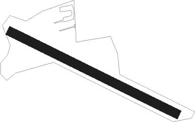
| Runway 12 / 30 | ||
| length | 598m (1962ft) | |
| bearing | 110° / 290° | |
| width | 30m (98ft) | |
| surface | grass | |
| displ threshold | 21m (69ft) / 101m (331ft) | |
Nearby beacons
| code | identifier | dist | bearing | frequency |
|---|---|---|---|---|
| WTM | WITTMUNDHAFEN TACAN | 18.7 | 304° | 113.50 |
| WSN | WESER NDB | 28.7 | 88° | 378 |
| BMN | BREMEN VOR/DME | 29.7 | 112° | 117.45 |
| BND | DME | 30.4 | 111° | 113.65 |
| NDO | NORDHOLZ TACAN | 33.9 | 52° | 117.10 |
| HIG | BREMEN NDB | 34.2 | 108° | 318 |
| NDO | NORDHOLZ NDB | 38.1 | 58° | 372 |
| DP | DIEPHOLZ NDB | 45.9 | 153° | 325 |
| DHE | HELGOLAND VOR/DME | 52.2 | 349° | 116.30 |
Disclaimer
The information on this website is not for real aviation. Use this data with the X-Plane flight simulator only! Data taken with kind consent from X-Plane 12 source code and data files. Content is subject to change without notice.