Aßlar - Asslarer Huette
Airport details
| Country | Germany |
| State | Hesse |
| Region | |
| Airspace | Langen Ctr |
| Municipality | Aßlar |
| Elevation | 728ft (222m) |
| Timezone | GMT +1 |
| Coordinates | 50.59773, 8.44436 |
| Magnetic var | |
| Type | land |
| Available since | X-Plane v10.32 |
| ICAO code | EDX5 |
| IATA code | n/a |
| FAA code | n/a |
Communication
| Asslarer Huette Asslar Info | 129.975 |
Nearby Points of Interest:
Evangelische Kirche (Aßlar)
-Evangelische Kirche Berghausen (Aßlar)
-Schloss
-Evangelische Kirche (Werdorf)
-Evangelische Kirche Bechlingen (Aßlar)
-bakehouse (Hermannstein)
-Pfarrhaus (Hermannstein)
-Wetzlarer Straße 14 (Hermannstein)
-Amtsgericht Ehringshausen
-Altenberg Abbey, Solms
-Evangelische Kirche (Kölschhausen)
-Evangelische Kirche
-Evangelische Kirche (Niederlemp)
-Sixt-von-Armin-Kaserne
-Brodschirm 6 (Wetzlar)
-Zur alten Münz
-Engelsgasse 2 (Wetzlar)
-Courthouses in Wetzlar
-Evangelische Kirche Daubhausen
-Bergstraße 24
-Jüdischer Friedhof Katzenfurt
-Spilburg
-Evangelische Kirche Großaltenstädten
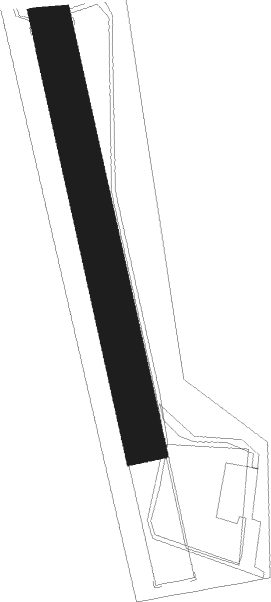
Runway info
| Runway 17 / 35 | ||
| length | 513m (1683ft) | |
| bearing | 348° / 168° | |
| width | 50m (164ft) | |
| surface | grass | |
Nearby beacons
| code | identifier | dist | bearing | frequency |
|---|---|---|---|---|
| SIL | SIEGERLAND NDB | 12.6 | 285° | 489 |
| SLD | DME | 15.3 | 287° | 108.05 |
| TAU | TAUNUS VOR/DME | 23.4 | 219° | 113.35 |
| MTR | METRO VOR | 24.7 | 128° | 110 |
| GED | GEDERN VORTAC | 32.7 | 103° | 110.80 |
| FR | FRANKFURT NDB | 33.2 | 156° | 297 |
| FFM | FRANKFURT VORTAC | 33.4 | 160° | 114.20 |
| WIB | WIESBADEN TACAN | 33.5 | 194° | 114.10 |
| COL | COLA VOR/DME | 34.2 | 282° | 108.80 |
| FRD | DME | 34.4 | 168° | 115.90 |
| FW | FRANKFURT NDB | 35.6 | 181° | 382 |
| VFM | NAUHEIM VOR | 38.2 | 178° | 113.75 |
| GMH | GERMINGHAUSEN VOR/DME | 40.2 | 316° | 115.40 |
| CHA | CHARLIE VOR/DME | 46.6 | 139° | 115.35 |
| FTZ | FRITZLAR NDB | 47 | 63° | 468 |
| RID | RIED VOR/DME | 49.1 | 173° | 112.20 |
| WRB | WARBURG VOR/DME | 60 | 36° | 113.70 |
| DKS | DME-ILS | 61.3 | 49° | 111.50 |
| DWI | DORTMUND-WICKEDE NDB | 63.5 | 319° | 357 |
| DOR | WICKEDE (DORTMUND) VOR/DME | 63.6 | 319° | 108.65 |
Disclaimer
The information on this website is not for real aviation. Use this data with the X-Plane flight simulator only! Data taken with kind consent from X-Plane 12 source code and data files. Content is subject to change without notice.