Schwalmstadt - Schwalmstadt Ziegenhain
Airport details
| Country | Germany |
| State | Hesse |
| Region | |
| Airspace | Langen Ctr |
| Municipality | Ziegenhain |
| Elevation | 694ft (212m) |
| Timezone | GMT +1 |
| Coordinates | 50.90432, 9.23853 |
| Magnetic var | |
| Type | land |
| Available since | X-Plane v10.40 |
| ICAO code | EDX6 |
| IATA code | n/a |
| FAA code | n/a |
Communication
| Schwalmstadt Ziegenhain Schwalmstadt Info | 123.375 |
Nearby Points of Interest:
Ziegenhain fortress
-Heilig-Geist-Hospital Treysa
-Kirche Allendorf an der Landsburg
-Altes Burghaus Schrecksbach
-Dreifaltigkeitskirche Neustadt
-Evangelische Kirche Christerode
-Kirche Arnshain
-Berfaer Straße 5
-Jüdischer Friedhof Angenrod
-Evangelische Kirche (Billertshausen)
-Johanneskirche (Arnsbach)
-Amtsgericht Alsfeld
-Beinhaus
-Amthof 15 (Alsfeld)
-Amthof 13 (Alsfeld)
-Weinhaus
-Apotheke am Rathaus
-Hochzeitshaus
-Amthof 10 (Alsfeld)
-Amthof 17 (Alsfeld)
-Amthof 8 (Alsfeld)
-Baugasse 1
-Amthof 4/6 (Alsfeld)
-Amthof 2 (Alsfeld)
-Am Kreuz 4, 6 (Alsfeld)
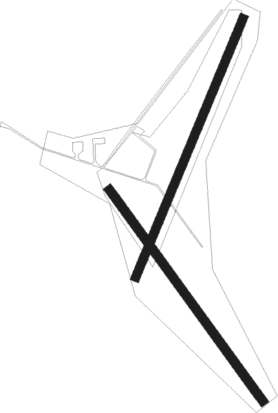
Runway info
Runway 14 / 32  | ||
| length | 889m (2917ft) | |
| bearing | 136° / 316° | |
| width | 30m (98ft) | |
| surface | grass | |
| Runway 03 / 21 | ||
| length | 954m (3130ft) | |
| bearing | 39° / 219° | |
| width | 30m (98ft) | |
| surface | grass | |
Nearby beacons
| code | identifier | dist | bearing | frequency |
|---|---|---|---|---|
| FTZ | FRITZLAR NDB | 12.7 | 44° | 468 |
| FUL | FULDA VOR/DME | 22.6 | 133° | 112.10 |
| GED | GEDERN VORTAC | 29.5 | 179° | 110.80 |
| DKS | DME-ILS | 31.6 | 18° | 111.50 |
| WRB | WARBURG VOR/DME | 36.4 | 348° | 113.70 |
| MTR | METRO VOR | 40.5 | 212° | 110 |
| PAD | DME-ILS | 48.3 | 319° | 108.50 |
| PAD | PADERBORN-LIPPSTADT NDB | 48.7 | 320° | 354 |
| FR | FRANKFURT NDB | 54.6 | 213° | 297 |
| FFM | FRANKFURT VORTAC | 56 | 215° | 114.20 |
| FRD | DME | 58.4 | 217° | 115.90 |
| CHA | CHARLIE VOR/DME | 59.5 | 191° | 115.35 |
| FW | FRANKFURT NDB | 62.2 | 222° | 382 |
| WIB | WIESBADEN TACAN | 62.5 | 227° | 114.10 |
| VFM | NAUHEIM VOR | 63.7 | 219° | 113.75 |
Disclaimer
The information on this website is not for real aviation. Use this data with the X-Plane flight simulator only! Data taken with kind consent from X-Plane 12 source code and data files. Content is subject to change without notice.