Flensburg - Flensburg Schaeferhaus
Airport details
| Country | Germany |
| State | Schleswig-Holstein |
| Region | ED |
| Airspace | Bremen Ctr |
| Municipality | Flensburg |
| Elevation | 128ft (39m) |
| Timezone | GMT +1 |
| Coordinates | 54.77333, 9.37883 |
| Magnetic var | |
| Type | land |
| Available since | X-Plane v10.40 |
| ICAO code | EDXF |
| IATA code | FLF |
| FAA code | n/a |
Communication
| Flensburg Schaeferhaus Flensburg Info | 122.850 |
| Flensburg Schaeferhaus BREMEN INFO | 125.100 |
Nearby Points of Interest:
St. Michaelkirche
-Malteser Krankenhaus St. Franziskus-Hospital
-Hans-Christiansen-Haus
-Heinrich-Sauermann-Haus
-Logenhaus
-Burg Schöneck
-Nikolai-Apotheke
-Kaufmannshaus Hansen
-Schrangen
-Steinbach-Haus
-Westindienspeicher
-Panzerkaserne
-Eckener Haus
-Deutsches Haus
-St. Marien-Mädchenschule I
-Europa-Haus
-Schwarzer Walfisch
-Thormählen Haus
-Margarethenhof (Flensburg)
-Hübsch-Speicher
-Ehrenhain
-Bonte-Kaserne
-Mürwiker Strasse 183-185
-Kapitänshaus Sonwik
-Fördestraße 1
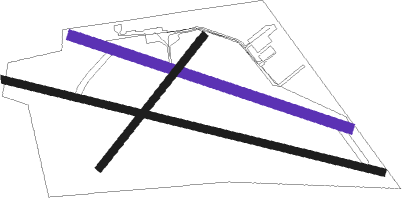
Runway info
Runway 11 / 29  | ||
| length | 1573m (5161ft) | |
| bearing | 101° / 281° | |
| width | 30m (98ft) | |
| surface | asphalt | |
| displ threshold | 298m (978ft) / 243m (797ft) | |
| Runway 11L / 29R | ||
| length | 1172m (3845ft) | |
| bearing | 104° / 284° | |
| width | 40m (131ft) | |
| surface | grass | |
| Runway 04 / 22 | ||
| length | 673m (2208ft) | |
| bearing | 58° / 238° | |
| width | 30m (98ft) | |
| surface | grass | |
Nearby beacons
| code | identifier | dist | bearing | frequency |
|---|---|---|---|---|
| SWG | SCHLESWIG TACAN | 19.2 | 156° | 111.80 |
| ALS | ALSIE VOR | 22.6 | 78° | 114.70 |
| VO | VOJENS/SKRYDSTRUP NDB | 27.3 | 347° | 321 |
| SKR | VOJENS/SKRYDSTRUP VORTAC | 27.9 | 340° | 110.40 |
| HNT | HOHN TACAN | 28.3 | 161° | 115.30 |
| HN | HOHN NDB | 28.7 | 147° | 344 |
| SLT | WESTERLAND/SYLT NDB | 33.9 | 275° | 387 |
| KIL | KIEL-HOLTENAU NDB | 35 | 118° | 353 |
| KHD | (HOLTENAU) DME-ILS | 35.6 | 117° | 109.50 |
| VAM | DME | 39.9 | 356° | 110.05 |
| KD | KOLDING NDB | 40.2 | 356° | 357 |
| EJ | ESBJERG NDB | 51.6 | 319° | 400 |
| ESE | DME | 53 | 312° | 116.60 |
| HP | ESBJERG NDB | 55.3 | 307° | 376 |
| NDO | NORDHOLZ NDB | 62.6 | 210° | 372 |
Disclaimer
The information on this website is not for real aviation. Use this data with the X-Plane flight simulator only! Data taken with kind consent from X-Plane 12 source code and data files. Content is subject to change without notice.