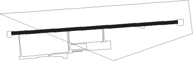
Melle - Melle-groenegau
Airport details
| Country | Germany |
| State | Lower Saxony |
| Region | ED |
| Airspace | Bremen Ctr |
| Municipality | Melle |
| Elevation | 234ft (71m) |
| Timezone | GMT +1 |
| Coordinates | 52.20052, 8.37899 |
| Magnetic var | |
| Type | land |
| Available since | X-Plane v10.40 |
| ICAO code | EDXG |
| IATA code | n/a |
| FAA code | n/a |
Communication
| Melle-Groenegau Melle Info | 125.835 |
Nearby Points of Interest:
Schloss Bruche
-Nonnenstein Observation Tower
-Burg Blankena
-Holter Kirche
-Museum Bünde
-Gut Hudenbeck
-Amtsgericht Halle (Westf.)
-Horse mill Oberbauerschaft
-Haus Hiddenhausen
-Schloss Holtfeld
-Freibad Lübbecke
-Sankt Johannes der Täufer, Bohmte
-Wellensiek
-Elsbachhaus
-Technisches Rathaus
-St. Joseph (Bielefeld)
-Amtsgericht Herford
-Ostmannturm
-Süsternkapelle
-Justizvollzugsanstalt Herford
-Haus der Technik
-Jüdisches Gemeindehaus (Herford)
-Church of the Nativity of the Virgin Mary
-Crüwell-Haus (Bielefeld)
-Battig-Haus
Nearby beacons
| code | identifier | dist | bearing | frequency |
|---|---|---|---|---|
| OSB | OSNABRUCK TACAN | 3.4 | 270° | 108.35 |
| OSN | OSNABRUECK VOR | 3.4 | 270° | 114.30 |
| MYN | MUENSTER/OSNABRUECK NDB | 21.4 | 266° | 371 |
| DP | DIEPHOLZ NDB | 23.6 | 11° | 325 |
| MOD | DME | 25.7 | 265° | 114.05 |
| BYC | BUECKEBURG NDB | 26.7 | 83° | 368 |
| HMM | HAMM VOR/DME | 32.2 | 243° | 115.65 |
| PAD | PADERBORN-LIPPSTADT NDB | 35.9 | 156° | 354 |
| PAD | DME-ILS | 36.5 | 158° | 108.50 |
| NIE | NIENBURG VOR | 44.4 | 67° | 116.50 |
| DWI | DORTMUND-WICKEDE NDB | 49 | 228° | 357 |
| DOR | WICKEDE (DORTMUND) VOR/DME | 49.1 | 228° | 108.65 |
| WRB | WARBURG VOR/DME | 49.7 | 134° | 113.70 |
| BMN | BREMEN VOR/DME | 52.6 | 24° | 117.45 |
| BND | DME | 52.7 | 26° | 113.65 |
| HIG | BREMEN NDB | 54.5 | 32° | 318 |
Disclaimer
The information on this website is not for real aviation. Use this data with the X-Plane flight simulator only! Data taken with kind consent from X-Plane 12 source code and data files. Content is subject to change without notice.