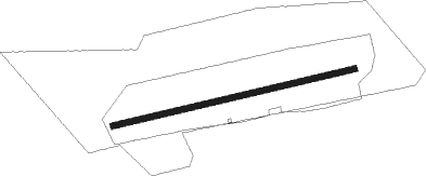
Sankt Michaelisdonn
Airport details
| Country | Germany |
| State | Schleswig-Holstein |
| Region | ED |
| Airspace | Bremen Ctr |
| Municipality | Sankt Michaelisdonn |
| Elevation | 124ft (38m) |
| Timezone | GMT +1 |
| Coordinates | 53.97833, 9.14333 |
| Magnetic var | |
| Type | land |
| Available since | X-Plane v10.40 |
| ICAO code | EDXM |
| IATA code | n/a |
| FAA code | n/a |
Communication
| Sankt Michaelisdonn St. Michel INFO | 122.500 |
Nearby Points of Interest:
Wasserturm Brunsbüttel
-St. Nikolauskirche
-St.-Nicolai-Kirche
-Schloss Heiligenstedten
-St. Severinkirche
-St. Severi
-Nagelsche Fachwerkhäuser
-Amtsgericht Itzehoe
-St.-Anschar-Kirche
-Wasmer-Palais
-Glückstädter Schloss
-Brockdorff-Palais
-Königshof (Glückstadt)
-Ehemaliges Frauengefängnis Glückstadt
-Rigmor
-Wetterwarte Cuxhaven
-Rathaus Cuxhaven
-Deichstraße 5 bis 8
-Deichstraße 4
-Wasserturm Remmels
-Eisenbahnbrücke Hechthausen
-Gut Seestermühe
-Boker Kanal
-Bederkesa railway station
Nearby beacons
| code | identifier | dist | bearing | frequency |
|---|---|---|---|---|
| NDO | NORDHOLZ NDB | 16.6 | 240° | 372 |
| NDO | NORDHOLZ TACAN | 21.4 | 247° | 117.10 |
| HNT | HOHN TACAN | 24.3 | 50° | 115.30 |
| HN | HOHN NDB | 27.9 | 57° | 344 |
| SWG | SCHLESWIG TACAN | 31.9 | 38° | 111.80 |
| ALF | DME | 36.5 | 112° | 115.80 |
| WSN | WESER NDB | 39 | 203° | 378 |
| KIL | KIEL-HOLTENAU NDB | 41.8 | 68° | 353 |
| HIG | BREMEN NDB | 56.4 | 194° | 318 |
| BND | DME | 57.5 | 201° | 113.65 |
| BMN | BREMEN VOR/DME | 57.6 | 202° | 117.45 |
| SLT | WESTERLAND/SYLT NDB | 58.6 | 320° | 387 |
| WES | DME-ILS | 62.6 | 319° | 111.50 |
| ALS | ALSIE VOR | 63 | 43° | 114.70 |
Disclaimer
The information on this website is not for real aviation. Use this data with the X-Plane flight simulator only! Data taken with kind consent from X-Plane 12 source code and data files. Content is subject to change without notice.