Seedorf
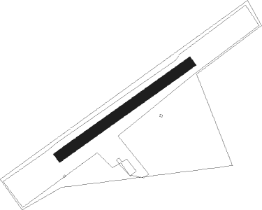
Airport details
| Country | Germany |
| State | Lower Saxony |
| Region | ED |
| Airspace | Bremen Ctr |
| Municipality | Seedorf |
| Elevation | 70ft (21m) |
| Timezone | GMT +1 |
| Coordinates | 53.33556, 9.25944 |
| Magnetic var | |
| Type | land |
| Available since | X-Plane v10.40 |
| ICAO code | EDXS |
| IATA code | n/a |
| FAA code | n/a |
Communication
| Seedorf Seedorf Info | 119.650 |
Nearby Points of Interest:
Alte Posthalterei
-Wassermühle Bademühlen
-Stalag X-B
-St. Margarethen (Gyhum)
-Dammgut
-Burg Clüversborstel
-Christophorus-Kirche
-Church Moisburg
-Amtsgericht Tostedt
-Johanneskirche
-St.-Marien-Kirche (Trupe)
-Sankt Antonius
-Altes Rathaus Stade
-Eisenbahnbrücke Hechthausen
-Wikingborg
-Wohnhaus Oberneulander Landstraße 141A
-Haus Schumacher
-Landhaus Böving
-Haus Hoogenkamp
-Landsitz Caesar-Ichon
-Brinksitzerhaus
-Gaststätte Meyer am Boom
-Haus Weyhausen
-Wohnhaus Lindenweg 12
-Landhaus Waldthausen
Nearby beacons
| code | identifier | dist | bearing | frequency |
|---|---|---|---|---|
| WSN | WESER NDB | 13.8 | 272° | 378 |
| HIG | BREMEN NDB | 21.3 | 231° | 318 |
| BND | DME | 24.5 | 239° | 113.65 |
| BMN | BREMEN VOR/DME | 24.9 | 240° | 117.45 |
| NDO | NORDHOLZ NDB | 31.4 | 315° | 372 |
| ALF | DME | 31.8 | 68° | 115.80 |
| NDO | NORDHOLZ TACAN | 33.8 | 306° | 117.10 |
| HAM | HAMBURG VORTAC | 39.7 | 70° | 113.10 |
| FSB | FASSBERG NDB | 41.9 | 114° | 284 |
| NIE | NIENBURG VOR | 42.8 | 171° | 116.50 |
| CEL | CELLE NDB | 52.7 | 134° | 311 |
| HW | HANNOVER NDB | 53 | 162° | 358 |
| WUN | WUNSTORF TACAN | 53.2 | 169° | 114.85 |
| DP | DIEPHOLZ NDB | 53.3 | 227° | 325 |
| HAD | DME | 54.4 | 153° | 113.95 |
| HBD | DME | 54.8 | 156° | 116.90 |
| HA | HANNOVER NDB | 55.9 | 148° | 320 |
| HNT | HOHN TACAN | 59.4 | 16° | 115.30 |
| HN | HOHN NDB | 61.2 | 23° | 344 |
Disclaimer
The information on this website is not for real aviation. Use this data with the X-Plane flight simulator only! Data taken with kind consent from X-Plane 12 source code and data files. Content is subject to change without notice.