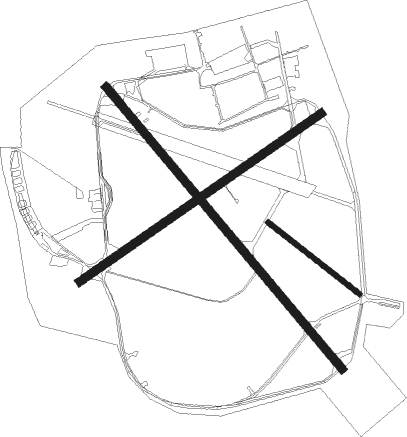
Westerland - Westerland Sylt
Airport details
| Country | Germany |
| State | Schleswig-Holstein |
| Region | ED |
| Airspace | Bremen Ctr |
| Municipality | Sylt |
| Elevation | 46ft (14m) |
| Timezone | GMT +1 |
| Coordinates | 54.91164, 8.34239 |
| Magnetic var | |
| Type | land |
| Available since | X-Plane v10.40 |
| ICAO code | EDXW |
| IATA code | GWT |
| FAA code | n/a |
Communication
| Westerland Sylt SYLT ATIS | 118.400 |
| Westerland Sylt Sylt Tower | 119.750 |
| Westerland Sylt BREMEN RADAR | 120.225 |
Approach frequencies
| ILS-cat-I | RW32 | 111.5 | 18.00mi |
| 3° GS | RW32 | 111.5 | 18.00mi |
Runway info
Nearby beacons
| code | identifier | dist | bearing | frequency |
|---|---|---|---|---|
| WES | DME-ILS | 0.1 | 248° | 111.50 |
| SLT | WESTERLAND/SYLT NDB | 4 | 129° | 387 |
| SKR | VOJENS/SKRYDSTRUP VORTAC | 35.5 | 70° | 110.40 |
| HP | ESBJERG NDB | 36.1 | 7° | 376 |
| VO | VOJENS/SKRYDSTRUP NDB | 37.1 | 71° | 321 |
| ESE | DME | 37.4 | 19° | 116.60 |
| EJ | ESBJERG NDB | 39.7 | 30° | 400 |
| DHE | HELGOLAND VOR/DME | 46.1 | 211° | 116.30 |
| VAM | DME | 46.4 | 62° | 110.05 |
| KD | KOLDING NDB | 46.6 | 62° | 357 |
Departure and arrival routes
| Transition altitude | 5000ft |
| SID end points | distance | outbound heading | |
|---|---|---|---|
| RW14 | |||
| OLDI1S | 22mi | 129° | |
| RW32 | |||
| OLDI1N | 22mi | 129° | |
Instrument approach procedures
| runway | airway (heading) | route (dist, bearing) |
|---|---|---|
| RW14 | OLDI1 (9°) | OLDIP 3000ft XW143 (17mi, 284°) XW142 (16mi, 325°) 3000ft XW141 (5mi, 68°) 1500ft |
| RW14 | OLDI2 (9°) | OLDIP 3000ft XW144 (18mi, 294°) XW142 (14mi, 309°) 3000ft XW141 (5mi, 68°) 1500ft |
| RNAV | XW141 1500ft EDANI (4mi, 129°) 1500ft EDXW (5mi, 129°) 82ft OLDIP (22mi, 129°) 3000ft OLDIP (turn) | |
| RW32 | OLDIP (309°) | OLDIP 3000ft XW321 (8mi, 309°) 3000ft |
| RNAV | XW321 3000ft VATUM (4mi, 309°) 3000ft EDXW (10mi, 309°) 81ft XW320 (3mi, 309°) OLDIP (25mi, 129°) 3000ft OLDIP (turn) |
Disclaimer
The information on this website is not for real aviation. Use this data with the X-Plane flight simulator only! Data taken with kind consent from X-Plane 12 source code and data files. Content is subject to change without notice.

