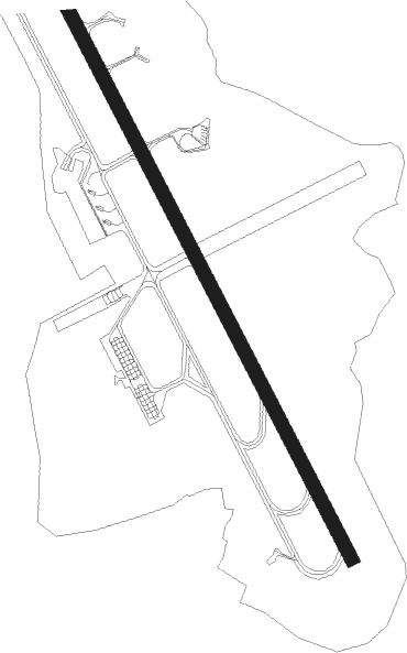
Kuopio / Siilinjärvi - Kuopio
Airport details
| Country | Finland |
| State | Eastern Finland |
| Region | EF |
| Airspace | Helsinki Ctr |
| Municipality | Siilinjärvi |
| Elevation | 323ft (98m) |
| Timezone | GMT +2 |
| Coordinates | 63.00861, 27.79445 |
| Magnetic var | |
| Type | land |
| Available since | X-Plane v10.40 |
| ICAO code | EFKU |
| IATA code | KUO |
| FAA code | n/a |
Communication
| Kuopio ATIS | 113.000 |
| Kuopio Tower | 119.700 |
| Kuopio Tower | 120.150 |
| Kuopio Approach | 130.600 |
| Kuopio Approach | 119.700 |
Approach frequencies
| ILS-cat-I | RW33 | 110.3 | 18.00mi |
| 3° GS | RW33 | 110.3 | 18.00mi |
Nearby Points of Interest:
Niuvanniemi hospital
-Kuopio Port
-State Provincial Office of Kuopio
-Väinölänniemi
-Niirala
-Juankoski old church
Nearby beacons
| code | identifier | dist | bearing | frequency |
|---|---|---|---|---|
| VEH | VEHKAA (KUOPIO) VOR/DME | 1.8 | 146° | 113 |
Departure and arrival routes
| Transition altitude | 5000ft |
| SID end points | distance | outbound heading | |
|---|---|---|---|
| RW15 | |||
| ETEN3C | 29mi | 101° | |
| ATLU3C | 27mi | 183° | |
| ASTU3C | 29mi | 217° | |
| NISP3C | 25mi | 246° | |
| UGLU3C | 25mi | 339° | |
| RW33 | |||
| ETEN3E | 29mi | 101° | |
| ATLU3E | 27mi | 183° | |
| ASTU3E | 29mi | 217° | |
| NISP3E | 25mi | 246° | |
| UGLU3E | 25mi | 339° | |
| STAR starting points | distance | inbound heading | |
|---|---|---|---|
| RW15 | |||
| ATLU4F | 26.5 | 3° | |
| NISP3F | 25.4 | 66° | |
| UGLU2F | 24.7 | 159° | |
| ETEN4F | 28.6 | 281° | |
| RW33 | |||
| ATLU2D | 26.5 | 3° | |
| NISP2D | 25.4 | 66° | |
| UGLU2D | 24.7 | 159° | |
| ETEN2D | 28.6 | 281° | |
Instrument approach procedures
| runway | airway (heading) | route (dist, bearing) |
|---|---|---|
| RW15 | BADMA (137°) | BADMA 2700ft |
| RW15 | NIMGA (186°) | NIMGA 2700ft BADMA (5mi, 259°) 2700ft |
| RW15 | UMPIL (112°) | UMPIL 2700ft BADMA (5mi, 79°) 2700ft |
| RNAV | BADMA 2700ft BEXOT (5mi, 137°) 1900ft EFKU (5mi, 138°) 357ft GILUV (11mi, 137°) 2700ft | |
| RW33 | ATGOS (3°) | ATGOS 2700ft GILUV (5mi, 79°) 2700ft |
| RW33 | GILUV (317°) | GILUV 2700ft |
| RW33 | TUPNO (293°) | TUPNO 2700ft GILUV (5mi, 259°) 2700ft |
| RNAV | GILUV 2700ft SOXAS (5mi, 317°) 2000ft EFKU (6mi, 317°) 374ft BADMA (11mi, 317°) 2700ft |
Holding patterns
| STAR name | hold at | type | turn | heading* | altitude | leg | speed limit |
|---|---|---|---|---|---|---|---|
| ATLU2D | GILUV | VHF | right | 146 (326)° | > 2700ft | 1.0min timed | 230 |
| ATLU4F | BADMA | VHF | left | 326 (146)° | > 2700ft | 1.0min timed | 230 |
| ETEN2D | GILUV | VHF | right | 146 (326)° | > 2700ft | 1.0min timed | 230 |
| ETEN4F | BADMA | VHF | left | 326 (146)° | > 2700ft | 1.0min timed | 230 |
| NISP2D | GILUV | VHF | right | 146 (326)° | > 2700ft | 1.0min timed | 230 |
| NISP3F | BADMA | VHF | left | 326 (146)° | > 2700ft | 1.0min timed | 230 |
| UGLU2D | GILUV | VHF | right | 146 (326)° | > 2700ft | 1.0min timed | 230 |
| UGLU2F | BADMA | VHF | left | 326 (146)° | > 2700ft | 1.0min timed | 230 |
| *) magnetic outbound (inbound) holding course | |||||||
Disclaimer
The information on this website is not for real aviation. Use this data with the X-Plane flight simulator only! Data taken with kind consent from X-Plane 12 source code and data files. Content is subject to change without notice.