Airports for X-Plane offers a convenient way to explore airports and their related communication information for the X-Plane flight simulator. It only uses data from the X-Plane flight simulator itself, and is therefore more reliable than the data that comes from real aviation websites. You can search for airports by using the ICAO code, or browse for airports per country and state. The information displayed is categorized by airport details, runway information, airport communication, approach frequencies (ILS and Glidepath details), details of nearby beacons, SIDs, STARs and approach procedures.

ferry hospital jetliner helipad transit stopover passengers nation traffic taxiway non-towered airport rail transport flights luggage airport authority stolport aircraft airport check-in station frankfurt airport

Flookburgh - Cark

Airport details

CountryUnited Kingdom
StateEngland
Region
AirspaceLondon Ctr
MunicipalitySouth Lakeland
Elevation17ft (5m)
TimezoneGMT +0
Coordinates54.16299, -2.96460
Magnetic var
Typeland
Available sinceX-Plane v10.40
ICAO codeEG15
IATA coden/a
FAA coden/a

Communication

No airport communication available for EG15
Nearby Points of Interest:
Grange Over Sands Lido
-
Conishead Priory
-
Castle Head Field Centre
-
Lindeth Tower
-
Swarthmoor Hall
-
Arnside and Silverdale
-
Ashton House
-
Dallam Tower
-
Kirkby Moor
-
Cowmire Hall and wall running approximately 20 metres to east, with gate piers
-
Rampside Hall
-
Borwick Hall
-
Custom House, Lancaster
-
St John the Baptist's Church, Blawith
-
Lancaster Carriage and Wagon Works
-
The Storey
-
Windermere House
-
The Barracks, White Cross
-
Capernwray Chapel
-
Lancaster Royal Grammar School
-
Barrow Park Cenotaph
-
Capernwray Hall
-
Trinity Church, Barrow-in-Furness
-
Cooke's Building
-
Oxford Chambers

Runway info

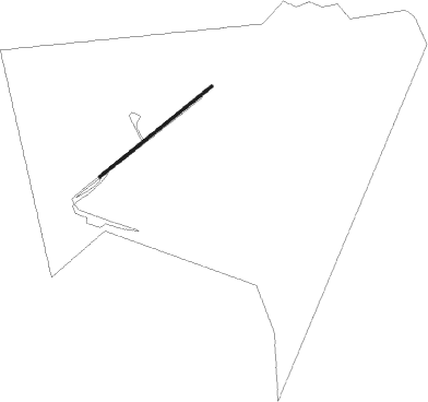
Runway 06 / 24
 length521m (1709ft)
 bearing68° / 248°
 width11m (34ft)
 surfaceasphalt

Airport layout


Nearby beacons

codeidentifierdistbearingfrequency
WLBARROW (WALNEY ISLAND) NDB10.7263°385
BPLBLACKPOOL NDB23.5189°318
WTNWARTON NDB25165°337
WTNWARTON TACAN25.4169°113.20
DCSCROSS DME36326°115.20
DUFDUN FELL DME3645°115.25
POLPOLE HILL VOR/DME39.5116°112.10
WALWALLASEY VOR/DME46.6192°114.10
LPLLIVERPOOL NDB50.1164°349
MCTMANCHESTER VOR/DME54.4139°113.55
HAWHAWARDEN NDB59181°340
WHIWHITEGATE NDB59.9161°368

Disclaimer

The information on this website is not for real aviation. Use this data with the X-Plane flight simulator only! Data taken with kind consent from X-Plane 12 source code and data files. Content is subject to change without notice.