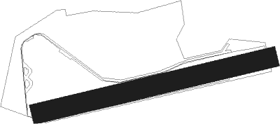
Husbands Bosworth
Airport details
| Country | United Kingdom |
| State | England |
| Region | |
| Airspace | London Ctr |
| Municipality | Harborough District |
| Elevation | 503ft (153m) |
| Timezone | GMT +0 |
| Coordinates | 52.43746, -1.05047 |
| Magnetic var | |
| Type | land |
| Available since | X-Plane v10.40 |
| ICAO code | EG55 |
| IATA code | n/a |
| FAA code | n/a |
Communication
Nearby Points of Interest:
Bosworth Hall
-Battle of Naseby
-Cromwell Cottage
-The Tower House, Lubenham
-The Town Hall
-Arthingworth Manor
-Dow Bridge
-Coton House
-Lamport Hall
-Brownsover Hall
-Ullesthorpe Mill
-Carlton Curlieu Hall
-Holdenby House
-Birch Spinney and Mawsley Marsh
-Bilton Hall
-Noseley Hall
-Narborough Hall
-Fielding Johnson Building
-Arch of Remembrance
-Moot Hall
-Skeffington Hall
-Leicester Town Hall
-Leicester Castle
-Turkey Cafe
-Scraptoft Hall
Nearby beacons
| code | identifier | dist | bearing | frequency |
|---|---|---|---|---|
| LE | LEICESTER NDB | 10.1 | 5° | 383 |
| DTY | DAVENTRY VOR/DME | 15.6 | 194° | 116.40 |
| WIT | WITTERING TACAN | 22.6 | 73° | 117.60 |
| HON | HONILEY VOR/DME | 22.9 | 262° | 113.65 |
| EME | EAST MIDLANDS NDB | 24.3 | 340° | 353 |
| BHX | BIRMINGHAM NDB | 25.7 | 271° | 406 |
| CIT | CRANFIELD NDB | 25.8 | 122° | 850 |
| EMW | EAST MIDLANDS NDB | 27.7 | 314° | 393 |
| TNL | TATENHILL NDB | 34.5 | 298° | 327 |
| WCO | WESTCOTT NDB | 35.2 | 171° | 335 |
| OX | OXFORD NDB | 37.6 | 204° | 367 |
| CWL | CRANWELL NDB | 40.8 | 44° | 423 |
| CWZ | CRANWELL TACAN | 41 | 44° | 117.40 |
| HEN | HENTON NDB | 41.8 | 159° | 433 |
| TNT | TRENT VOR/DME | 43.3 | 315° | 115.70 |
| LUT | LUTON NDB | 43.8 | 124° | 345 |
| BZ | BRIZE NORTON NDB | 46 | 219° | 386 |
| BZN | BRIZE NORTON TACAN | 46.1 | 219° | 111.90 |
| BNN | BOVINGDON VOR/DME | 46.5 | 145° | 113.75 |
| CAM | CAMBRIDGE NDB | 47.2 | 100° | 332 |
| WAD | WADDINGTON TACAN | 47.6 | 36° | 117.10 |
| BKY | BARKWAY VOR/DME | 48.9 | 112° | 116.25 |
| BSO | BENSON TACAN | 49.4 | 183° | 110 |
| CGY | CONINGSBY TACAN | 50.6 | 53° | 111.10 |
| GAM | GAMSTON VOR/DME | 50.8 | 7° | 112.80 |
| CHT | CHILTERN NDB | 52.7 | 147° | 277 |
| FFA | FAIRFORD TACAN | 53.1 | 225° | 113.40 |
| BPK | BROOKMANS PARK VOR/DME | 54 | 126° | 117.50 |
| MLD | MILDENHALL TACAN | 56.5 | 93° | 115.90 |
| BUR | BURNHAM NDB | 56.8 | 158° | 421 |
| CPT | COMPTON VOR/DME | 57.1 | 190° | 114.35 |
| LKH | LAKENHEATH TACAN | 58.5 | 91° | 110.20 |
| WOD | WOODLEY NDB | 59.4 | 170° | 352 |
| MAM | MARHAM TACAN | 60.1 | 83° | 108.70 |
| LON | LONDON VOR/DME | 61 | 148° | 113.60 |
| LAM | LAMBOURNE VOR/DME | 65 | 123° | 115.60 |
| LCY | LONDON CITY NDB | 69.6 | 130° | 322 |
Disclaimer
The information on this website is not for real aviation. Use this data with the X-Plane flight simulator only! Data taken with kind consent from X-Plane 12 source code and data files. Content is subject to change without notice.