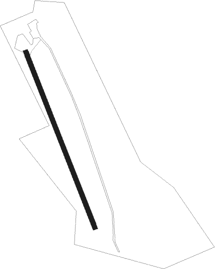
Cleobury Mortimer - Milson
Airport details
| Country | United Kingdom |
| State | England |
| Region | |
| Airspace | London Ctr |
| Municipality | Milson |
| Elevation | 500ft (152m) |
| Timezone | GMT +0 |
| Coordinates | 52.36275, -2.54604 |
| Magnetic var | |
| Type | land |
| Available since | X-Plane v10.40 |
| ICAO code | EG70 |
| IATA code | n/a |
| FAA code | n/a |
Communication
Nearby Points of Interest:
Mawley Hall
-Sodington Hall
-Henley Hall
-Kinlet Hall
-Downton Hall
-Abberley Clock Tower
-Abberley Hall
-Oakley Park
-Richard's Castle
-Woodbury Hill Camp
-Old St Bartholomew's Church, Lower Sapey
-Ribbesford House
-Bewdley Bridge
-Eye Manor
-The White House, Aston Munslow
-Pool House, Worcestershire
-Millichope Park
-Astley Hall
-Onibury Station And Platform Rooms
-Downton Castle
-Medieval Settlement, south-east of Upton Cressett Hall
-Upton Cressett Hall
-St Michael's Church, Upton Cressett
-Whitbourne Hall
-Gatley Park
Nearby beacons
| code | identifier | dist | bearing | frequency |
|---|---|---|---|---|
| WBA | WOLVERHAMPTON NDB | 13.8 | 62° | 356 |
| WOL | DME | 13.8 | 62° | 108.60 |
| SH | SHOBDON NDB | 14.2 | 250° | 426 |
| SWB | SHAWBURY VOR/DME | 26.4 | 345° | 116.80 |
| WPL | WELSHPOOL NDB | 27.4 | 294° | 323 |
| BHX | BIRMINGHAM NDB | 29.5 | 83° | 406 |
| GST | GLOUCESTERSHIRE NDB | 31.5 | 141° | 331 |
| HON | HONILEY VOR/DME | 32.3 | 90° | 113.65 |
| TNL | TATENHILL NDB | 39.3 | 60° | 327 |
| BCN | BRECON VOR/DME | 46.5 | 228° | 117.45 |
| FFA | FAIRFORD TACAN | 49.3 | 132° | 113.40 |
| WHI | WHITEGATE NDB | 49.4 | 355° | 368 |
| OF | FILTON NDB | 50.5 | 183° | 325 |
| BZ | BRIZE NORTON NDB | 50.7 | 123° | 386 |
| BZN | BRIZE NORTON TACAN | 50.7 | 123° | 111.90 |
| HAW | HAWARDEN NDB | 51.4 | 332° | 340 |
| TNT | TRENT VOR/DME | 52.3 | 52° | 115.70 |
| LPL | LIVERPOOL NDB | 59 | 350° | 349 |
| BRI | BRISTOL NDB | 59.2 | 190° | 414 |
| MCT | MANCHESTER VOR/DME | 60.5 | 16° | 113.55 |
| CDF | CARDIFF NDB | 65.2 | 219° | 388 |
Disclaimer
The information on this website is not for real aviation. Use this data with the X-Plane flight simulator only! Data taken with kind consent from X-Plane 12 source code and data files. Content is subject to change without notice.