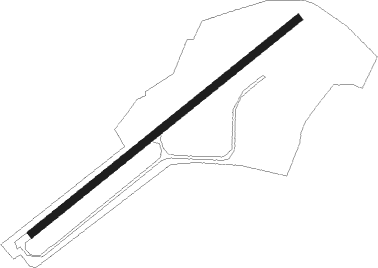
Bruntingthorpe
Airport details
| Country | United Kingdom |
| State | England |
| Region | EG |
| Airspace | London Ctr |
| Municipality | Harborough District |
| Elevation | 464ft (141m) |
| Timezone | GMT +0 |
| Coordinates | 52.48459, -1.14818 |
| Magnetic var | |
| Type | land |
| Available since | X-Plane v10.40 |
| ICAO code | EG74 |
| IATA code | n/a |
| FAA code | n/a |
Communication
Nearby Points of Interest:
Ullesthorpe Mill
-Bosworth Hall
-Coton House
-Dow Bridge
-Narborough Hall
-Brownsover Hall
-The Tower House, Lubenham
-Battle of Naseby
-Cromwell Cottage
-Carlton Curlieu Hall
-Fielding Johnson Building
-The Town Hall
-Arch of Remembrance
-Leicester Castle
-Leicester Town Hall
-Turkey Cafe
-Bilton Hall
-Church of St Mark
-Arthingworth Manor
-Towers Hospital Blocks 29, 30, 36, 37, 38, 39, 40, And 41
-Noseley Hall
-Scraptoft Hall
-Red Hill filling station
-Groby Old Hall
-Groby Castle
Nearby beacons
| code | identifier | dist | bearing | frequency |
|---|---|---|---|---|
| LE | LEICESTER NDB | 8.4 | 43° | 383 |
| DTY | DAVENTRY VOR/DME | 18.3 | 174° | 116.40 |
| HON | HONILEY VOR/DME | 20.3 | 256° | 113.65 |
| EME | EAST MIDLANDS NDB | 20.9 | 352° | 353 |
| BHX | BIRMINGHAM NDB | 22.1 | 267° | 406 |
| EMW | EAST MIDLANDS NDB | 23.4 | 318° | 393 |
| WIT | WITTERING TACAN | 24.8 | 79° | 117.60 |
| TNL | TATENHILL NDB | 30 | 298° | 327 |
| CIT | CRANFIELD NDB | 30.4 | 121° | 850 |
| WCO | WESTCOTT NDB | 38.5 | 164° | 335 |
| TNT | TRENT VOR/DME | 39 | 317° | 115.70 |
| OX | OXFORD NDB | 39.6 | 195° | 367 |
| CWL | CRANWELL NDB | 40.4 | 51° | 423 |
| CWZ | CRANWELL TACAN | 40.5 | 51° | 117.40 |
| HEN | HENTON NDB | 45.4 | 154° | 433 |
| WAD | WADDINGTON TACAN | 46.6 | 42° | 117.10 |
| BZ | BRIZE NORTON NDB | 47.2 | 212° | 386 |
| BZN | BRIZE NORTON TACAN | 47.3 | 212° | 111.90 |
| GAM | GAMSTON VOR/DME | 48.4 | 14° | 112.80 |
| LUT | LUTON NDB | 48.4 | 123° | 345 |
| BNN | BOVINGDON VOR/DME | 50.6 | 142° | 113.75 |
| CGY | CONINGSBY TACAN | 50.9 | 58° | 111.10 |
| CAM | CAMBRIDGE NDB | 51.5 | 102° | 332 |
| BSO | BENSON TACAN | 52.2 | 177° | 110 |
| FFA | FAIRFORD TACAN | 53.8 | 219° | 113.40 |
| CHT | CHILTERN NDB | 56.7 | 144° | 277 |
| CPT | COMPTON VOR/DME | 59.6 | 184° | 114.35 |
| FNY | DONCASTER SHEFFIELD NDB | 59.7 | 8° | 338 |
| MLD | MILDENHALL TACAN | 60.3 | 94° | 115.90 |
| BUR | BURNHAM NDB | 60.5 | 154° | 421 |
| LKH | LAKENHEATH TACAN | 62.2 | 93° | 110.20 |
| MAM | MARHAM TACAN | 63.1 | 85° | 108.70 |
| LON | LONDON VOR/DME | 64.9 | 146° | 113.60 |
| LAM | LAMBOURNE VOR/DME | 69.5 | 123° | 115.60 |
Disclaimer
The information on this website is not for real aviation. Use this data with the X-Plane flight simulator only! Data taken with kind consent from X-Plane 12 source code and data files. Content is subject to change without notice.