Shotton Colliery - Peterlee
Airport details
| Country | United Kingdom |
| State | England |
| Region | |
| Airspace | London Ctr |
| Municipality | Easington Village |
| Elevation | 450ft (137m) |
| Timezone | GMT +0 |
| Coordinates | 54.76817, -1.38925 |
| Magnetic var | |
| Type | land |
| Available since | X-Plane v10.40 |
| ICAO code | EG80 |
| IATA code | n/a |
| FAA code | n/a |
Communication
| Peterlee Peterlee Drop Zone | 129.900 |
Nearby Points of Interest:
The Castle, Castle Eden
-Cassop Vale
-Pittington Hill
-Former Gilesgate Railway Station
-Doxford House
-Old Shire Hall (University Office)
-Langford House
-Bishop Cosin's Hall
-Town Hall and Guildhall
-Bishop Cosin's Library
-Butterby Oxbow
-Chorister School
-Durham University Observatory
-Battle of Neville's Cross
-The Manor House
-Burn Hall
-Sunderland Synagogue
-Sunderland Orphan Asylum
-Phoenix Hall
-Whitworth Hall, County Durham
-Windlestone Hall
-St Cuthbert's Church, Redmarshall
-Bishop Auckland Town Hall Arts Centre
-Globe Theatre
-Underhill
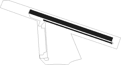
Runway info
Runway 12 / 30  | ||
| length | 641m (2103ft) | |
| bearing | 104° / 284° | |
| width | 30m (98ft) | |
| surface | grass | |
| Runway 12R / 30L | ||
| length | 551m (1808ft) | |
| bearing | 104° / 284° | |
| width | 7m (23ft) | |
| surface | asphalt | |
Nearby beacons
| code | identifier | dist | bearing | frequency |
|---|---|---|---|---|
| TD | TEESSIDE INTL NDB | 12.6 | 165° | 347 |
| NT | NEWCASTLE NDB | 19 | 318° | 352 |
| NEW | DME | 19.4 | 311° | 114.25 |
| LEE | LEEMING TACAN | 28.7 | 197° | 112.60 |
| LBA | LEEDS BRADFORD NDB | 55 | 196° | 402 |
| SBL | SHERBURN-IN-ELMET NDB | 59.1 | 170° | 323 |
Disclaimer
The information on this website is not for real aviation. Use this data with the X-Plane flight simulator only! Data taken with kind consent from X-Plane 12 source code and data files. Content is subject to change without notice.