Coventry
Airport details
| Country | United Kingdom |
| State | England |
| Region | EG |
| Airspace | London Ctr |
| Municipality | Warwick |
| Elevation | 267ft (81m) |
| Timezone | GMT +0 |
| Coordinates | 52.37173, -1.48144 |
| Magnetic var | |
| Type | land |
| Available since | X-Plane v10.32 |
| ICAO code | EGBE |
| IATA code | CVT |
| FAA code | n/a |
Communication
| Coventry Tower | 123.830 |
Nearby Points of Interest:
Baginton Castle
-The Charterhouse, Coventry
-Mediaeval Stone Building, Coventry
-Coventry Council House
-Drapers' Hall
-St Mary's Guildhall
-Coventry city walls
-22 Bayley Lane
-St. Mary's Priory and Cathedral
-Blue Coat School
-Houses for Visiting Mathematicians
-Stoneleigh Abbey Gatehouse
-Brandon Castle
-Bird Grove House
-29th Division War Memorial
-65, Birmingham Road
-Lillington Library
-Offchurch Bury
-Dormer Cottage
-Town Hall
-Birdingbury Hall
-Royal Pump Rooms
-Berkswell Hall
-Castle Bridge
-Shire Hall
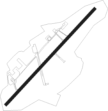
Runway info
| Runway 05 / 23 | ||
| length | 2010m (6594ft) | |
| bearing | 61° / 241° | |
| width | 46m (151ft) | |
| surface | asphalt | |
| displ threshold | 184m (604ft) / 209m (686ft) | |
Nearby beacons
| code | identifier | dist | bearing | frequency |
|---|---|---|---|---|
| HON | HONILEY VOR/DME | 6.7 | 265° | 113.65 |
| BHX | BIRMINGHAM NDB | 11.1 | 287° | 406 |
| DTY | DAVENTRY VOR/DME | 17.7 | 118° | 116.40 |
| LE | LEICESTER NDB | 21.5 | 62° | 383 |
| EMW | EAST MIDLANDS NDB | 27.4 | 3° | 393 |
| TNL | TATENHILL NDB | 28.5 | 327° | 327 |
| EME | EAST MIDLANDS NDB | 29.5 | 32° | 353 |
| WBA | WOLVERHAMPTON NDB | 29.8 | 280° | 356 |
| WOL | DME | 29.8 | 280° | 108.60 |
| OX | OXFORD NDB | 32.8 | 164° | 367 |
| WCO | WESTCOTT NDB | 36.5 | 135° | 335 |
| CIT | CRANFIELD NDB | 36.9 | 105° | 850 |
| BZ | BRIZE NORTON NDB | 37.6 | 191° | 386 |
| BZN | BRIZE NORTON TACAN | 37.7 | 191° | 111.90 |
| GST | GLOUCESTERSHIRE NDB | 38.3 | 235° | 331 |
| WIT | WITTERING TACAN | 38.6 | 76° | 117.60 |
| TNT | TRENT VOR/DME | 41.5 | 345° | 115.70 |
| FFA | FAIRFORD TACAN | 43 | 205° | 113.40 |
| HEN | HENTON NDB | 44.7 | 132° | 433 |
| BSO | BENSON TACAN | 47.6 | 153° | 110 |
| BNN | BOVINGDON VOR/DME | 51.8 | 125° | 113.75 |
| CWL | CRANWELL NDB | 53.3 | 57° | 423 |
| CWZ | CRANWELL TACAN | 53.5 | 57° | 117.40 |
| CPT | COMPTON VOR/DME | 53.7 | 163° | 114.35 |
| CHT | CHILTERN NDB | 57.3 | 128° | 277 |
| GAM | GAMSTON VOR/DME | 57.9 | 30° | 112.80 |
| WAD | WADDINGTON TACAN | 58.9 | 50° | 117.10 |
| BUR | BURNHAM NDB | 59.2 | 137° | 421 |
| WOD | WOODLEY NDB | 59.5 | 147° | 352 |
| MCT | MANCHESTER VOR/DME | 65.5 | 322° | 113.55 |
| MLD | MILDENHALL TACAN | 72.2 | 90° | 115.90 |
| LKH | LAKENHEATH TACAN | 74.4 | 89° | 110.20 |
Departure and arrival routes
| Transition altitude | 6000ft |
| STAR starting points | distance | inbound heading | |
|---|---|---|---|
| ALL | |||
| DOLO1B | 93.0 | 111° | |
| MAKU2B | 155.5 | 115° | |
| MALU1B | 99.2 | 116° | |
| AMPI1B | 79.3 | 116° | |
| WAL1B | 85.6 | 122° | |
| CHAS4B | 84.5 | 140° | |
| CHAS3G | 85.4 | 156° | |
| CHAS3H | 70.9 | 160° | |
| CHAS3F | 109.6 | 160° | |
| HEME1B | 51.8 | 298° | |
| SILV1B | 36.0 | 318° | |
Holding patterns
| STAR name | hold at | type | turn | heading* | altitude | leg | speed limit |
|---|---|---|---|---|---|---|---|
| AMPI1B | CHASE | VHF | right | 329 (149)° | 5000ft - 14000ft | 1.0min timed | 210 |
| CHAS3F | CHASE | VHF | right | 329 (149)° | 5000ft - 14000ft | 1.0min timed | 210 |
| CHAS3G | CHASE | VHF | right | 329 (149)° | 5000ft - 14000ft | 1.0min timed | 210 |
| CHAS3H | CHASE | VHF | right | 329 (149)° | 5000ft - 14000ft | 1.0min timed | 210 |
| CHAS4B | CHASE | VHF | right | 329 (149)° | 5000ft - 14000ft | 1.0min timed | 210 |
| DOLO1B | CHASE | VHF | right | 329 (149)° | 5000ft - 14000ft | 1.0min timed | 210 |
| HEME1B | GROVE | VHF | right | 283 (103)° | 7000ft - 14000ft | 1.0min timed | 210 |
| MAKU2B | CHASE | VHF | right | 329 (149)° | 5000ft - 14000ft | 1.0min timed | 210 |
| MALU1B | CHASE | VHF | right | 329 (149)° | 5000ft - 14000ft | 1.0min timed | 210 |
| SILV1B | GROVE | VHF | right | 283 (103)° | 7000ft - 14000ft | 1.0min timed | 210 |
| WAL1B | CHASE | VHF | right | 329 (149)° | 5000ft - 14000ft | 1.0min timed | 210 |
| *) magnetic outbound (inbound) holding course | |||||||
Disclaimer
The information on this website is not for real aviation. Use this data with the X-Plane flight simulator only! Data taken with kind consent from X-Plane 12 source code and data files. Content is subject to change without notice.