Wolverhampton
Airport details
| Country | United Kingdom |
| State | England |
| Region | EG |
| Airspace | London Ctr |
| Municipality | South Staffordshire |
| Elevation | 283ft (86m) |
| Timezone | GMT +0 |
| Coordinates | 52.51772, -2.25978 |
| Magnetic var | |
| Type | land |
| Available since | X-Plane v10.40 |
| ICAO code | EGBO |
| IATA code | n/a |
| FAA code | n/a |
Communication
| Wolverhampton ATIS | 124.875 |
| Wolverhampton Tower | 123.000 |
| Wolverhampton Approach | 123.000 |
Nearby Points of Interest:
Holbeche House
-Dudmaston Hall
-Davenport House
-St Mary's Church, Patshull
-Patshull Hall
-Stourbridge Town Hall
-Wrottesley Hall
-Wren's Nest
-Catholic Church of St Mary and St John
-The Law Courts
-Wolverhampton Civic Hall
-Catholic Church of St Peter and St Paul
-Wolverhampton Pillar
-Priory Hall
-Council House
-Queen's Building, Wolverhampton
-Chubb Locks
-Dudley Castle
-Wolverhampton Low Level railway station
-Grotto At Sj 7756 0290
-The Boat Gauging House, Tipton Canal Basin (Off Factory Road) Birmingham Canal Birmingham Level
-Wychbury Ring
-Apley Hall
-Bilston Town Hall
-The Town Hall
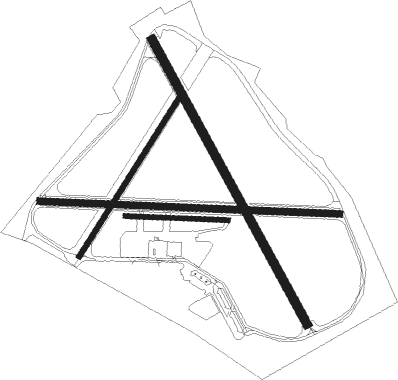
Runway info
Runway 16 / 34  | ||
| length | 1113m (3652ft) | |
| bearing | 144° / 324° | |
| width | 30m (98ft) | |
| surface | asphalt | |
| displ threshold | 197m (646ft) / 139m (456ft) | |
| Runway 10 / 28 | ||
| length | 1031m (3383ft) | |
| bearing | 94° / 274° | |
| width | 23m (75ft) | |
| surface | asphalt | |
| displ threshold | 141m (463ft) / 108m (354ft) | |
| Runway 10L / 28R | ||
| length | 353m (1158ft) | |
| bearing | 94° / 274° | |
| width | 15m (49ft) | |
| surface | grass | |
| Runway 04 / 22 | ||
| length | 637m (2090ft) | |
| bearing | 51° / 231° | |
| width | 18m (59ft) | |
| surface | asphalt | |
| displ threshold | 121m (397ft) / 0m (0ft) | |
Nearby beacons
| code | identifier | dist | bearing | frequency |
|---|---|---|---|---|
| WBA | WOLVERHAMPTON NDB | 0.1 | 228° | 356 |
| WOL | DME | 0.1 | 227° | 108.60 |
| BHX | BIRMINGHAM NDB | 18.9 | 97° | 406 |
| SWB | SHAWBURY VOR/DME | 22.3 | 305° | 116.80 |
| HON | HONILEY VOR/DME | 23.8 | 105° | 113.65 |
| TNL | TATENHILL NDB | 25.3 | 59° | 327 |
| SH | SHOBDON NDB | 28 | 246° | 426 |
| WPL | WELSHPOOL NDB | 33.3 | 277° | 323 |
| EMW | EAST MIDLANDS NDB | 34.7 | 69° | 393 |
| GST | GLOUCESTERSHIRE NDB | 37.7 | 172° | 331 |
| TNT | TRENT VOR/DME | 38.6 | 48° | 115.70 |
| WHI | WHITEGATE NDB | 42.1 | 331° | 368 |
| HAW | HAWARDEN NDB | 47.5 | 313° | 340 |
| MCT | MANCHESTER VOR/DME | 50.4 | 360° | 113.55 |
| BZ | BRIZE NORTON NDB | 52.1 | 139° | 386 |
| BZN | BRIZE NORTON TACAN | 52.1 | 140° | 111.90 |
| LPL | LIVERPOOL NDB | 52.1 | 330° | 349 |
| FFA | FAIRFORD TACAN | 53 | 151° | 113.40 |
| OX | OXFORD NDB | 53.6 | 126° | 367 |
| OF | FILTON NDB | 61.1 | 198° | 325 |
| WAL | WALLASEY VOR/DME | 61.3 | 315° | 114.10 |
Disclaimer
The information on this website is not for real aviation. Use this data with the X-Plane flight simulator only! Data taken with kind consent from X-Plane 12 source code and data files. Content is subject to change without notice.