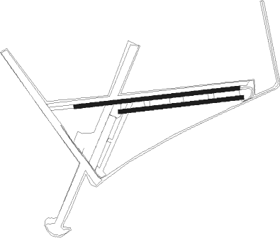
Turweston - Turweston Aerodrome
Airport details
| Country | United Kingdom |
| State | England |
| Region | EG |
| Airspace | London Ctr |
| Municipality | Buckinghamshire |
| Elevation | 448ft (137m) |
| Timezone | GMT +0 |
| Coordinates | 52.03981, -1.10198 |
| Magnetic var | |
| Type | land |
| Available since | X-Plane v10.40 |
| ICAO code | EGBT |
| IATA code | n/a |
| FAA code | n/a |
Communication
| Turweston Aerodrome Turweston Radio | 122.180 |
Nearby Points of Interest:
Astwell Castle
-Weston Hall
-Old Town Hall
-Yeomanry Hall And Attached Building Bordering Yard To South Yeomanry House
-The Cottage
-Thenford House
-Town Hall
-St Michael and All Angels' Church, Thornton
-Eydon Hall
-Easton Neston
-Chacombe Priory
-Wardington Manor
-Edgcote House
-Town Hall Town Hall And Attached Walls
-Battle of Cropredy Bridge
-Stoke Bruerne Canal Museum
-Middleton Park, Oxfordshire
-Blisworth Rectory Farm Quarry
-Winslow War Memorial
-Cosgrove aqueduct
-Gayton Manor House
-Whaddon Hall
-Rousham House
-Horwood House
-Wroxton Abbey

Nearby beacons
| code | identifier | dist | bearing | frequency |
|---|---|---|---|---|
| DTY | DAVENTRY VOR/DME | 8.4 | 355° | 116.40 |
| WCO | WESTCOTT NDB | 12.3 | 143° | 335 |
| OX | OXFORD NDB | 14.8 | 227° | 367 |
| HEN | HENTON NDB | 20.4 | 132° | 433 |
| CIT | CRANFIELD NDB | 20.8 | 81° | 850 |
| BZ | BRIZE NORTON NDB | 25.4 | 240° | 386 |
| BSO | BENSON TACAN | 25.5 | 180° | 110 |
| BZN | BRIZE NORTON TACAN | 25.5 | 240° | 111.90 |
| BNN | BOVINGDON VOR/DME | 27.8 | 120° | 113.75 |
| HON | HONILEY VOR/DME | 28.1 | 299° | 113.65 |
| LUT | LUTON NDB | 32.6 | 100° | 345 |
| CHT | CHILTERN NDB | 33 | 126° | 277 |
| CPT | COMPTON VOR/DME | 33.2 | 192° | 114.35 |
| FFA | FAIRFORD TACAN | 33.5 | 243° | 113.40 |
| LE | LEICESTER NDB | 34.1 | 7° | 383 |
| BHX | BIRMINGHAM NDB | 34.5 | 303° | 406 |
| BUR | BURNHAM NDB | 35 | 141° | 421 |
| WOD | WOODLEY NDB | 36.2 | 159° | 352 |
| WIT | WITTERING TACAN | 40.6 | 47° | 117.60 |
| BPK | BROOKMANS PARK VOR/DME | 40.7 | 106° | 117.50 |
| LON | LONDON VOR/DME | 40.7 | 131° | 113.60 |
| BLC | DME | 44 | 160° | 116.20 |
| BLK | BLACKBUSHE NDB | 44 | 160° | 328 |
| EME | EAST MIDLANDS NDB | 47.7 | 353° | 353 |
| CAM | CAMBRIDGE NDB | 48.4 | 82° | 332 |
| ODH | ODIHAM TACAN | 48.7 | 169° | 109.60 |
| EMW | EAST MIDLANDS NDB | 49.1 | 336° | 393 |
| OCK | OCKHAM VOR/DME | 50.4 | 138° | 115.30 |
| EPM | EPSOM NDB | 51 | 135° | 316 |
| LAM | LAMBOURNE VOR/DME | 52.1 | 107° | 115.60 |
| TNL | TATENHILL NDB | 52.5 | 319° | 327 |
| BDN | BOSCOMBE DOWN TACAN | 58.7 | 216° | 108.20 |
| MLD | MILDENHALL TACAN | 61.6 | 79° | 115.90 |
| MID | MIDHURST VOR/DME | 61.8 | 154° | 114 |
| CWL | CRANWELL NDB | 63.3 | 32° | 423 |
| CWZ | CRANWELL TACAN | 63.5 | 32° | 117.40 |
| LKH | LAKENHEATH TACAN | 64.5 | 77° | 110.20 |
| MAM | MARHAM TACAN | 71 | 70° | 108.70 |
| SND | SOUTHEND NDB | 72.4 | 104° | 362 |
Disclaimer
The information on this website is not for real aviation. Use this data with the X-Plane flight simulator only! Data taken with kind consent from X-Plane 12 source code and data files. Content is subject to change without notice.