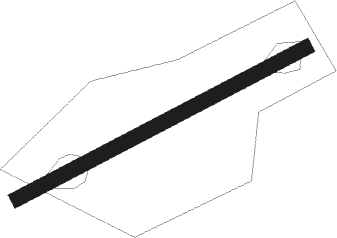
Manchester - Manchester Woodford
Airport details
| Country | United Kingdom |
| State | England |
| Region | EG |
| Airspace | London Ctr |
| Municipality | Cheshire East |
| Elevation | 293ft (89m) |
| Timezone | GMT +0 |
| Coordinates | 53.33805, -2.14889 |
| Magnetic var | |
| Type | land |
| Available since | X-Plane v10.40 |
| ICAO code | EGCD |
| IATA code | n/a |
| FAA code | n/a |
Communication
Nearby Points of Interest:
New Hall, Woodford
-Adlington Hall
-Dean Row Chapel, Wilmslow
-Bonis Hall
-Mottram Hall
-Handforth Hall
-Legh Old Hall
-Millington Hall
-Clarence Mill
-Bollington Methodist Church
-Hawthorn Hall
-Fulshaw Hall
-White Nancy
-Pownall Hall
-Old Manor Farm, Marple
-Moseley Old Hall, Cheadle
-Stockport Town Hall
-Chorley Old Hall
-Abney Hall
-Woodbank, Stockport
-Whirley Hall
-Underbank Hall
-Barnes Hospital
-Hurdsfield House
-Saltersley Hall
Nearby beacons
| code | identifier | dist | bearing | frequency |
|---|---|---|---|---|
| MCT | MANCHESTER VOR/DME | 4.2 | 279° | 113.55 |
| WHI | WHITEGATE NDB | 19.3 | 252° | 368 |
| LPL | LIVERPOOL NDB | 20.6 | 270° | 349 |
| TNT | TRENT VOR/DME | 24.2 | 121° | 115.70 |
| POL | POLE HILL VOR/DME | 24.4 | 6° | 112.10 |
| HAW | HAWARDEN NDB | 31.3 | 259° | 340 |
| TNL | TATENHILL NDB | 34.3 | 144° | 327 |
| WTN | WARTON NDB | 35.3 | 300° | 337 |
| WAL | WALLASEY VOR/DME | 35.4 | 273° | 114.10 |
| WTN | WARTON TACAN | 35.7 | 299° | 113.20 |
| LBA | LEEDS BRADFORD NDB | 36.2 | 43° | 402 |
| SWB | SHAWBURY VOR/DME | 37.3 | 224° | 116.80 |
| EMW | EAST MIDLANDS NDB | 39.5 | 126° | 393 |
| BPL | BLACKPOOL NDB | 40.8 | 296° | 318 |
| SBL | SHERBURN-IN-ELMET NDB | 43.1 | 64° | 323 |
| EME | EAST MIDLANDS NDB | 45.8 | 118° | 353 |
| WBA | WOLVERHAMPTON NDB | 49.5 | 188° | 356 |
| WOL | DME | 49.5 | 188° | 108.60 |
| BHX | BIRMINGHAM NDB | 54.9 | 156° | 406 |
| HON | HONILEY VOR/DME | 61.5 | 154° | 113.65 |
| LEE | LEEMING TACAN | 61.5 | 33° | 112.60 |
Disclaimer
The information on this website is not for real aviation. Use this data with the X-Plane flight simulator only! Data taken with kind consent from X-Plane 12 source code and data files. Content is subject to change without notice.
