Church Fenton - Leeds East
Airport details
| Country | United Kingdom |
| State | England |
| Region | EG |
| Airspace | London Ctr |
| Municipality | Selby |
| Elevation | 27ft (8m) |
| Timezone | GMT +0 |
| Coordinates | 53.83443, -1.19541 |
| Magnetic var | |
| Type | land |
| Available since | X-Plane v10.40 |
| ICAO code | EGCM |
| IATA code | n/a |
| FAA code | n/a |
Communication
| Leeds East Fenton Radio | 126.500 |
Nearby Points of Interest:
Cawood Bridge
-Grimston Park
-Battle of Towton
-Tadcaster Bridge
-Monk Fryston Hall
-Moreby Hall
-Healaugh Park Priory
-Becca Hall
-Bowcliffe Hall
-Boston House And Attached Wing Wall
-Thorp Arch Bridge
-Middlethorpe Hall
-Bramham Park
-85, 87 And 89, Micklegate
-Micklegate House And Attached Railings And Lamp Brackets
-Garforth House And Railings Attached At Front, Garden Wall Attached At Rear
-North Eastern Railway Company War Memorial
-St John's Church, Micklegate, York
-Cumberland House
-Female Prison, York
-More House
-Castlegate House And Attached Railings
-Lendal Tower
-The Herbert House
-golden fleece york
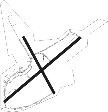
Runway info
Runway 06 / 24  | ||
| length | 1823m (5981ft) | |
| bearing | 67° / 247° | |
| width | 46m (151ft) | |
| surface | asphalt | |
| displ threshold | 115m (377ft) / 0m (0ft) | |
| blast zone | 0m (0ft) / 51m (167ft) | |
| Runway 16 / 34 | ||
| length | 1174m (3852ft) | |
| bearing | 143° / 323° | |
| width | 45m (148ft) | |
| surface | asphalt | |
| displ threshold | 152m (499ft) / 200m (656ft) | |
Nearby beacons
| code | identifier | dist | bearing | frequency |
|---|---|---|---|---|
| SBL | SHERBURN-IN-ELMET NDB | 2.7 | 196° | 323 |
| LBA | LEEDS BRADFORD NDB | 16.3 | 274° | 402 |
| FNY | DONCASTER SHEFFIELD NDB | 22.6 | 152° | 338 |
| LEE | LEEMING TACAN | 30.2 | 324° | 112.60 |
| POL | POLE HILL VOR/DME | 32.6 | 264° | 112.10 |
| KIM | HUMBERSIDE NDB | 33.7 | 107° | 365 |
| GAM | GAMSTON VOR/DME | 34.3 | 156° | 112.80 |
| TD | TEESSIDE INTL NDB | 43.8 | 349° | 347 |
| WAD | WADDINGTON TACAN | 46.7 | 135° | 117.10 |
| TNT | TRENT VOR/DME | 49.8 | 211° | 115.70 |
| CWZ | CRANWELL TACAN | 54.6 | 139° | 117.40 |
| CWL | CRANWELL NDB | 54.7 | 139° | 423 |
Disclaimer
The information on this website is not for real aviation. Use this data with the X-Plane flight simulator only! Data taken with kind consent from X-Plane 12 source code and data files. Content is subject to change without notice.