Winsford - Ashcroft
Airport details
| Country | United Kingdom |
| State | England |
| Region | EG |
| Airspace | London Ctr |
| Municipality | Little Budworth |
| Elevation | 147ft (45m) |
| Timezone | GMT +0 |
| Coordinates | 53.16417, -2.57150 |
| Magnetic var | |
| Type | land |
| Available since | X-Plane v10.32 |
| ICAO code | EGCR |
| IATA code | n/a |
| FAA code | n/a |
Communication
Nearby Points of Interest:
Monument to Captain John Francis Egerton
-Tilstone Lodge
-Abbotts Moss Nature Reserve
-Lea Hall, Wimboldsley
-Minshull Vernon United Reformed Church
-Stoke Hall
-Utkinton Hall
-The Chantry House
-Moulton War Memorial
-Bostock Hall
-Round Tower Lodge
-Oakmere Hall
-Tirley Garth
-Poole Hall
-Davenham Hall
-Ravenscroft Hall
-Hartford Manor
-Ravensmoor Windmill
-Clock Tower in Queen's Park
-River Dane
-Nantwich Workhouse
-Hefferston Grange
-Dock Road Edwardian Pumping Station
-Dorfold Hall
-Nantwich Aqueduct
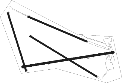
Runway info
Runway 13 / 31  | ||
| length | 435m (1427ft) | |
| bearing | 113° / 293° | |
| width | 9m (30ft) | |
| surface | grass | |
| Runway 09 / 27 | ||
| length | 515m (1690ft) | |
| bearing | 87° / 267° | |
| width | 12m (39ft) | |
| surface | grass | |
| Runway 12 / 30 | ||
| length | 355m (1165ft) | |
| bearing | 107° / 287° | |
| width | 9m (30ft) | |
| surface | grass | |
| Runway 17 / 35 | ||
| length | 340m (1115ft) | |
| bearing | 159° / 339° | |
| width | 8m (26ft) | |
| surface | grass | |
Nearby beacons
| code | identifier | dist | bearing | frequency |
|---|---|---|---|---|
| WHI | WHITEGATE NDB | 2.2 | 292° | 368 |
| LPL | LIVERPOOL NDB | 11.8 | 319° | 349 |
| HAW | HAWARDEN NDB | 14.7 | 272° | 340 |
| MCT | MANCHESTER VOR/DME | 16 | 58° | 113.55 |
| SWB | SHAWBURY VOR/DME | 22.2 | 194° | 116.80 |
| WAL | WALLASEY VOR/DME | 24.4 | 292° | 114.10 |
| TNT | TRENT VOR/DME | 33.1 | 97° | 115.70 |
| TNL | TATENHILL NDB | 35.8 | 113° | 327 |
| WTN | WARTON TACAN | 36.4 | 331° | 113.20 |
| WTN | WARTON NDB | 36.6 | 334° | 337 |
| WPL | DME | 38.3 | 227° | 115.95 |
| WPL | WELSHPOOL NDB | 38.4 | 227° | 323 |
| POL | POLE HILL VOR/DME | 38.6 | 39° | 112.10 |
| BPL | BLACKPOOL NDB | 40 | 323° | 318 |
| WBA | WOLVERHAMPTON NDB | 40.5 | 154° | 356 |
| WOL | DME | 40.5 | 154° | 108.60 |
| BHX | BIRMINGHAM NDB | 51.9 | 131° | 406 |
| LBA | LEEDS BRADFORD NDB | 53.3 | 53° | 402 |
| SH | SHOBDON NDB | 56.4 | 199° | 426 |
| HON | HONILEY VOR/DME | 58.6 | 132° | 113.65 |
| WL | BARROW (WALNEY ISLAND) NDB | 62.8 | 324° | 385 |
Disclaimer
The information on this website is not for real aviation. Use this data with the X-Plane flight simulator only! Data taken with kind consent from X-Plane 12 source code and data files. Content is subject to change without notice.