Lincoln - Sturgate
Airport details
| Country | United Kingdom |
| State | England |
| Region | EG |
| Airspace | London Ctr |
| Municipality | West Lindsey |
| Elevation | 58ft (18m) |
| Timezone | GMT +0 |
| Coordinates | 53.38111, -0.68528 |
| Magnetic var | |
| Type | land |
| Available since | X-Plane v10.40 |
| ICAO code | EGCS |
| IATA code | n/a |
| FAA code | n/a |
Communication
| Sturgate Safety com | 134.750 |
Nearby Points of Interest:
Coates medieval settlement and moated site
-Gainsborough Bridge
-Stow Park railway station
-St Nicholas' Church, Littleborough
-St Martin of Tours' Church, Saundby
-St Peter's Church, Normanby by Spital
-Kettlethorpe Hall
-Mount Pleasant Mill
-St Oswald's Church, Dunham-on-Trent
-Cleatham Hall
-St Andrew's Church, Redbourne
-Riseholme Hall
-Whimpton Moor medieval village and moated site
-St Gregory's Church, Fledborough
-St Giles' Church, Darlton
-Sloswicke's Hospital
-St Lawrence's Church, Snarford
-Town Hall
-The Old Barracks, Lincoln
-Kingerby Castle
-Holy Trinity Church, Everton
-Holy Trinity Hospital (Almshouses)
-Assize Courts
-Leigh-Pemberton House
-Twigmore Hall
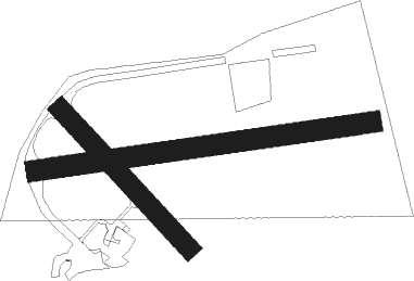
Runway info
Runway 09 / 27  | ||
| length | 794m (2605ft) | |
| bearing | 88° / 268° | |
| width | 49m (160ft) | |
| surface | asphalt | |
| displ threshold | 84m (276ft) / 0m (0ft) | |
| blast zone | 0m (0ft) / 30m (98ft) | |
| Runway 14 / 32 | ||
| length | 442m (1450ft) | |
| bearing | 127° / 307° | |
| width | 46m (150ft) | |
| surface | asphalt | |
Nearby beacons
| code | identifier | dist | bearing | frequency |
|---|---|---|---|---|
| GAM | GAMSTON VOR/DME | 11.1 | 249° | 112.80 |
| FNY | DONCASTER SHEFFIELD NDB | 12.6 | 286° | 338 |
| WAD | WADDINGTON TACAN | 14.1 | 144° | 117.10 |
| KIM | HUMBERSIDE NDB | 16.5 | 60° | 365 |
| CWZ | CRANWELL TACAN | 22.3 | 150° | 117.40 |
| CWL | CRANWELL NDB | 22.4 | 151° | 423 |
| CGY | CONINGSBY TACAN | 25.4 | 119° | 111.10 |
| OTR | OTTRINGHAM VOR/DME | 28.1 | 61° | 113.90 |
| SBL | SHERBURN-IN-ELMET NDB | 30.8 | 308° | 323 |
| EME | EAST MIDLANDS NDB | 37.7 | 223° | 353 |
| TNT | TRENT VOR/DME | 40.4 | 252° | 115.70 |
| EMW | EAST MIDLANDS NDB | 43.2 | 234° | 393 |
| LBA | LEEDS BRADFORD NDB | 45 | 297° | 402 |
| WIT | WITTERING TACAN | 46.9 | 166° | 117.60 |
| LE | LEICESTER NDB | 48.2 | 204° | 383 |
| LEE | LEEMING TACAN | 62.7 | 317° | 112.60 |
| MAM | MARHAM TACAN | 63 | 121° | 108.70 |
| LKH | LAKENHEATH TACAN | 73.6 | 128° | 110.20 |
Disclaimer
The information on this website is not for real aviation. Use this data with the X-Plane flight simulator only! Data taken with kind consent from X-Plane 12 source code and data files. Content is subject to change without notice.