Amesbury - Boscombe Down
Airport details
| Country | United Kingdom |
| State | England |
| Region | EG |
| Airspace | London Ctr |
| Municipality | Wiltshire |
| Elevation | 407ft (124m) |
| Timezone | GMT +0 |
| Coordinates | 51.16307, -1.75229 |
| Magnetic var | |
| Type | land |
| Available since | X-Plane v10.40 |
| ICAO code | EGDM |
| IATA code | n/a |
| FAA code | n/a |
Communication
| Boscombe Down Boscombe Ground | 130.750 |
| Boscombe Down Boscombe Tower | 129.750 |
| Boscombe Down Boscombe Zone | 126.700 |
| Boscombe Down Boscombe Approach | 130.000 |
Approach frequencies
| ILS-cat-I | RW23 | 109.1 | 18.00mi |
| 3° GS | RW23 | 109.1 | 18.00mi |
Nearby Points of Interest:
Amesbury Abbey
-All Saints Church, Idmiston
-Lake House
-Wilbury House
-North Wessex Downs
-Stonehenge, Avebury and Associated Sites
-Stonehenge Cursus
-Little Durnford Manor
-Tedworth House
-St Mary's Church, South Tidworth
-St Andrew's Church, Rollestone
-Frowds Almshouses
-Salisbury War Memorial And Railings
-The Guildhall
-Poultry Cross
-General Infirmary
-The Old George Inn
-North Gate
-College of Matrons
-Hemingsby House
-Bemerton Rectory
-Wren Hall
-Braybrooke House
-The King's House
-Amport House
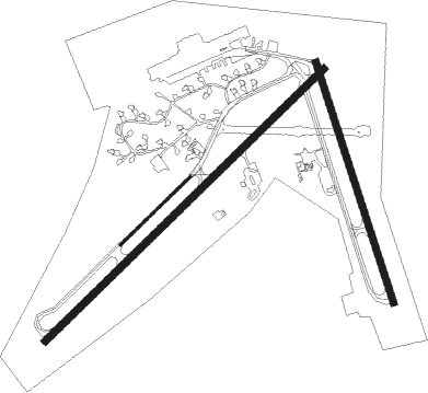
Runway info
Runway 05 / 23  | ||
| length | 3200m (10499ft) | |
| bearing | 62° / 242° | |
| width | 56m (185ft) | |
| surface | asphalt | |
| displ threshold | 0m (0ft) / 98m (322ft) | |
| Runway 05L / 23R | ||
| length | 800m (2625ft) | |
| bearing | 62° / 242° | |
| width | 24m (80ft) | |
| surface | asphalt | |
| displ threshold | 0m (0ft) / 35m (115ft) | |
| Runway 17 / 35 | ||
| length | 2080m (6824ft) | |
| bearing | 159° / 339° | |
| width | 56m (185ft) | |
| surface | asphalt | |
| displ threshold | 174m (571ft) / 0m (0ft) | |
Nearby beacons
| code | identifier | dist | bearing | frequency |
|---|---|---|---|---|
| BDN | BOSCOMBE DOWN TACAN | 0.8 | 181° | 108.20 |
| EAS | SOUTHAMPTON (EASTLEIGH) NDB | 19.4 | 118° | 391 |
| SAM | SOUTHAMPTON VOR/DME | 19.8 | 117° | 113.35 |
| BIA | BOURNEMOUTH NDB | 23.3 | 193° | 339 |
| CPT | COMPTON VOR/DME | 28 | 58° | 114.35 |
| ODH | ODIHAM TACAN | 30.5 | 85° | 109.60 |
| FFA | FAIRFORD TACAN | 31.1 | 355° | 113.40 |
| VLN | YEOVILTON TACAN | 34.7 | 260° | 111 |
| BLC | DME | 35.4 | 80° | 116.20 |
| BLK | BLACKBUSHE NDB | 35.4 | 80° | 328 |
| BZN | BRIZE NORTON TACAN | 35.5 | 14° | 111.90 |
| BZ | BRIZE NORTON NDB | 35.6 | 14° | 386 |
| BSO | BENSON TACAN | 36.5 | 55° | 110 |
| YVL | DME | 36.5 | 256° | 109.05 |
| YVL | YEOVIL NDB | 36.9 | 256° | 343 |
| WOD | WOODLEY NDB | 37.1 | 72° | 352 |
| OF | FILTON NDB | 38.1 | 293° | 325 |
| BRI | BRISTOL NDB | 38.5 | 283° | 414 |
| GWC | GOODWOOD VOR/DME | 41.9 | 107° | 114.75 |
| OX | OXFORD NDB | 43.3 | 33° | 367 |
| GST | GLOUCESTERSHIRE NDB | 46.4 | 330° | 331 |
| HEN | HENTON NDB | 50.7 | 58° | 433 |
| WCO | WESTCOTT NDB | 50.8 | 49° | 335 |
Disclaimer
The information on this website is not for real aviation. Use this data with the X-Plane flight simulator only! Data taken with kind consent from X-Plane 12 source code and data files. Content is subject to change without notice.