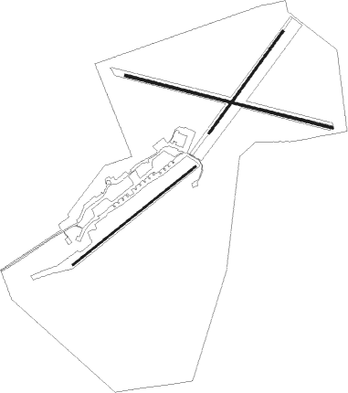
Netheravon
Airport details
| Country | United Kingdom |
| State | England |
| Region | EG |
| Airspace | London Ctr |
| Municipality | Wiltshire |
| Elevation | 455ft (139m) |
| Timezone | GMT +0 |
| Coordinates | 51.24713, -1.75426 |
| Magnetic var | |
| Type | land |
| Available since | X-Plane v10.40 |
| ICAO code | EGDN |
| IATA code | n/a |
| FAA code | n/a |
Communication
Nearby Points of Interest:
St Peter's Church, Everleigh
-Tedworth House
-St Mary's Church, South Tidworth
-Amesbury Abbey
-Stonehenge Cursus
-Stonehenge, Avebury and Associated Sites
-Brunton House
-North Wessex Downs
-Wilbury House
-Church of All Saints
-Lake House
-Marden Henge
-St Andrew's Church, Rollestone
-Redenham Park
-Biddesden House
-All Saints Church, Idmiston
-Oare House
-Amport House
-Knap Hill
-Urchfont Manor College
-Fosbury Camp
-Fosbury House
-Little Durnford Manor
-All Cannings Cross
-Bury Hill

Nearby beacons
| code | identifier | dist | bearing | frequency |
|---|---|---|---|---|
| BDN | BOSCOMBE DOWN TACAN | 5.9 | 179° | 108.20 |
| EAS | SOUTHAMPTON (EASTLEIGH) NDB | 23 | 126° | 391 |
| SAM | SOUTHAMPTON VOR/DME | 23.3 | 125° | 113.35 |
| CPT | COMPTON VOR/DME | 24.8 | 65° | 114.35 |
| FFA | FAIRFORD TACAN | 26.1 | 354° | 113.40 |
| BIA | BOURNEMOUTH NDB | 28.3 | 191° | 339 |
| ODH | ODIHAM TACAN | 30.3 | 91° | 109.60 |
| BZN | BRIZE NORTON TACAN | 30.6 | 17° | 111.90 |
| BZ | BRIZE NORTON NDB | 30.7 | 17° | 386 |
| BSO | BENSON TACAN | 32.9 | 61° | 110 |
| BLC | DME | 34.4 | 85° | 116.20 |
| BLK | BLACKBUSHE NDB | 34.4 | 85° | 328 |
| WOD | WOODLEY NDB | 35 | 77° | 352 |
| OF | FILTON NDB | 35.4 | 288° | 325 |
| VLN | YEOVILTON TACAN | 36.3 | 255° | 111 |
| BRI | BRISTOL NDB | 37 | 278° | 414 |
| YVL | DME | 38.6 | 251° | 109.05 |
| OX | OXFORD NDB | 38.7 | 36° | 367 |
| YVL | YEOVIL NDB | 38.9 | 251° | 343 |
| GST | GLOUCESTERSHIRE NDB | 41.6 | 327° | 331 |
| GWC | GOODWOOD VOR/DME | 44.4 | 111° | 114.75 |
| WCO | WESTCOTT NDB | 46.8 | 53° | 335 |
| HEN | HENTON NDB | 47.3 | 62° | 433 |
| DTY | DAVENTRY VOR/DME | 60.8 | 34° | 116.40 |
Disclaimer
The information on this website is not for real aviation. Use this data with the X-Plane flight simulator only! Data taken with kind consent from X-Plane 12 source code and data files. Content is subject to change without notice.