Predannack Wollas - Rnas Predannack
Airport details
| Country | United Kingdom |
| State | England |
| Region | EG |
| Airspace | London Ctr |
| Municipality | Cornwall |
| Elevation | 293ft (89m) |
| Timezone | GMT +0 |
| Coordinates | 50.00117, -5.23083 |
| Magnetic var | |
| Type | land |
| Available since | X-Plane v10.40 |
| ICAO code | EGDO |
| IATA code | n/a |
| FAA code | n/a |
Communication
| RNAS Predannack Tower | 122.100 |
| RNAS Predannack Approach | 134.050 |
Nearby Points of Interest:
Caerthillian to Kennack
-Goonhilly Downs
-Coverack to Porthoustock
-Wheal Trewavas
-Acton Castle
-Cornwall and West Devon Mining Landscape
-Royal Cornwall Polytechnic Society
-Glasney College
-Penberthy Croft mine
-St Michael's Mount castle
-Marazion Marsh RSPB Reserve
-West Cornwall Bryophytes Site of Special Scientific Interest
-South Pier
-The Bucket of Blood
-Carnon Mine Engine House
-Morrab Library
-Market Building, Penzance
-Public Buildings
-Carricknath Point to Porthbean Beach
-Mining Exchange
-Boleigh Fogou
-Treneere Manor
-Castle Horneck
-Trereife House
-Friends Meeting House, Come-to-Good
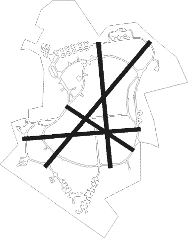
Runway info
Runway 05 / 23  | ||
| length | 1825m (5988ft) | |
| bearing | 57° / 237° | |
| width | 46m (151ft) | |
| surface | asphalt | |
| Runway 01 / 19 | ||
| length | 1392m (4567ft) | |
| bearing | 359° / 179° | |
| width | 46m (151ft) | |
| surface | asphalt | |
| Runway 09 / 27 | ||
| length | 1309m (4295ft) | |
| bearing | 90° / 270° | |
| width | 44m (144ft) | |
| surface | asphalt | |
| Runway 13 / 31 | ||
| length | 883m (2897ft) | |
| bearing | 116° / 296° | |
| width | 43m (141ft) | |
| surface | asphalt | |
Nearby beacons
| code | identifier | dist | bearing | frequency |
|---|---|---|---|---|
| CUL | CULDROSE NDB | 4.9 | 348° | 370 |
| LND | LANDS END VOR/DME | 17.6 | 288° | 114.20 |
| NQY | NEWQUAY NDB | 27.9 | 28° | 347 |
Disclaimer
The information on this website is not for real aviation. Use this data with the X-Plane flight simulator only! Data taken with kind consent from X-Plane 12 source code and data files. Content is subject to change without notice.