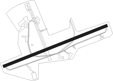
St. Athan - St Athan
Airport details
| Country | United Kingdom |
| State | Wales |
| Region | EG |
| Airspace | London Ctr |
| Municipality | Vale of Glamorgan |
| Elevation | 163ft (50m) |
| Timezone | GMT +0 |
| Coordinates | 51.40127, -3.43911 |
| Magnetic var | |
| Type | land |
| Available since | X-Plane v10.40 |
| ICAO code | EGDX |
| IATA code | GSY |
| FAA code | n/a |
Communication
| St Athan ATIS | 130.560 |
| St Athan Tower | 122.865 |
| St Athan Approach | 128.855 |
| St Athan CARDIFF Approach | 119.150 |
Nearby Points of Interest:
Gileston Manor
-Llantwit Major Town Hall
-St Illtyd's Church, Llantwit Major
-Dimlands
-Llanmihangel Place
-St Hilary's Church
-St Donat's Castle
-St Donat's Churchyard Cross
-Cowbridge Town Hall
-Cowbridge Grammar School
-Cowbridge town wall
-Church of the Holy Trinity
-Penllyn Castle
-Church Of St Donat
-Pwll-y-Wrach
-Lidmore
-Llansannor Court
-St Senwyr's Church
-Barry Island
-Barry Council Office and Library
-Barry Dock Offices
-River Ely
-Barry Lighthouse
-Coedarhydyglyn
-Dovecote At Cadoxton Court, Mount Pleasant, Cadoxton
Nearby beacons
| code | identifier | dist | bearing | frequency |
|---|---|---|---|---|
| CDF | CARDIFF NDB | 3.8 | 94° | 388 |
| BCN | BRECON VOR/DME | 20.5 | 29° | 117.45 |
| BRI | BRISTOL NDB | 27 | 92° | 414 |
| OF | FILTON NDB | 32.5 | 82° | 325 |
| VLN | YEOVILTON TACAN | 38.3 | 116° | 111 |
| EX | EXETER NDB | 39.3 | 167° | 337 |
| YVL | YEOVIL NDB | 40.1 | 121° | 343 |
| YVL | DME | 40.4 | 120° | 109.05 |
| SH | SHOBDON NDB | 54.6 | 34° | 426 |
Disclaimer
The information on this website is not for real aviation. Use this data with the X-Plane flight simulator only! Data taken with kind consent from X-Plane 12 source code and data files. Content is subject to change without notice.
