Fair Isle
Airport details
| Country | United Kingdom |
| State | Scotland |
| Region | EG |
| Airspace | Scottish Ctr |
| Municipality | Shetland |
| Elevation | 223ft (68m) |
| Timezone | GMT +0 |
| Coordinates | 59.53472, -1.62861 |
| Magnetic var | |
| Type | land |
| Available since | X-Plane v10.40 |
| ICAO code | EGEF |
| IATA code | FIE |
| FAA code | n/a |
Communication
| Fair Isle Fair Isle Radio | 118.025 |
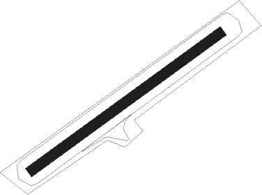
Runway info
| Runway 06 / 24 | ||
| length | 478m (1568ft) | |
| bearing | 73° / 253° | |
| width | 22m (72ft) | |
| surface | gravel | |
| blast zone | 28m (92ft) / 37m (121ft) | |
Nearby beacons
| code | identifier | dist | bearing | frequency |
|---|---|---|---|---|
| SBH | SUMBURGH NDB | 23.1 | 44° | 351 |
| SUM | SUMBURGH VOR/DME | 23.1 | 45° | 117.35 |
Disclaimer
The information on this website is not for real aviation. Use this data with the X-Plane flight simulator only! Data taken with kind consent from X-Plane 12 source code and data files. Content is subject to change without notice.