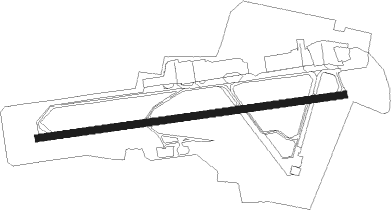
Bristol - Bristol Intl
Airport details
| Country | United Kingdom |
| State | England |
| Region | EG |
| Airspace | London Ctr |
| Municipality | Wrington |
| Elevation | 622ft (190m) |
| Timezone | GMT +0 |
| Coordinates | 51.38267, -2.71910 |
| Magnetic var | |
| Type | land |
| Available since | X-Plane v10.40 |
| ICAO code | EGGD |
| IATA code | BRS |
| FAA code | n/a |
Communication
| Bristol Intl Bristol Information | 126.030 |
| Bristol Intl Bristol Ground | 121.930 |
| Bristol Intl Bristol Tower | 133.850 |
| Bristol Intl Bristol Radar | 125.650 |
| Bristol Intl Bristol Director | 136.080 |
Approach frequencies
| ILS-cat-III | RW27 | 110.15 | 18.00mi |
| ILS-cat-I | RW09 | 110.15 | 18.00mi |
| 3° GS | RW09 | 110.15 | 18.00mi |
| 3° GS | RW27 | 110.15 | 18.00mi |
Nearby Points of Interest:
Lulsgate Quarry
-Goblin Combe
-Hartcliff Rocks Quarry
-Barrow Court
-Cleeve Toot Camp
-Fairy Toot
-King's Wood and Urchin Wood SSSI
-Littleton gunpowder works
-Plaster's Green Meadows
-Bourne SSSI, Avon
-Gatcombe Court
-Barns Batch Spinney
-Dundry Main Road South Quarry
-The Rectory, Chew Stoke
-The Vicarage, Congresbury
-Burrington Camp
-The Old Rectory, Yatton
-Over Langford Manor
-Burrington Combe
-Biddle Street, Yatton
-Tickenham, Nailsea and Kenn Moors SSSI
-Jubilee Clock Tower
-Old School Room, Chew Magna
-Sidney Hill Cottage Homes
-Chew Court
Nearby beacons
| code | identifier | dist | bearing | frequency |
|---|---|---|---|---|
| BRI | BRISTOL NDB | 0 | 128° | 414 |
| OF | FILTON NDB | 9.5 | 43° | 325 |
| VLN | YEOVILTON TACAN | 22.8 | 168° | 111 |
| CDF | CARDIFF NDB | 23.2 | 271° | 388 |
| YVL | YEOVIL NDB | 26.5 | 173° | 343 |
| YVL | DME | 26.6 | 172° | 109.05 |
| BCN | BRECON VOR/DME | 28.9 | 302° | 117.45 |
| GST | GLOUCESTERSHIRE NDB | 36.8 | 47° | 331 |
| FFA | FAIRFORD TACAN | 38.8 | 72° | 113.40 |
| BDN | BOSCOMBE DOWN TACAN | 38.9 | 104° | 108.20 |
| EX | EXETER NDB | 43.6 | 222° | 337 |
| BIA | BOURNEMOUTH NDB | 49.1 | 125° | 339 |
| SH | SHOBDON NDB | 52 | 349° | 426 |
| BHD | BERRY HEAD VOR/DME | 65.9 | 218° | 112.05 |
Departure and arrival routes
| Transition altitude | 6000ft |
| SID end points | distance | outbound heading | |
|---|---|---|---|
| RW09 | |||
| WOTA1Z | 20mi | 58° | |
| EXMO1Z | 27mi | 252° | |
| BCN1Z | 29mi | 302° | |
| RW27 | |||
| BADI1X | 18mi | 39° | |
| EXMO1X | 27mi | 252° | |
| BCN1X | 29mi | 302° | |
| STAR starting points | distance | inbound heading | |
|---|---|---|---|
| ALL | |||
| DAWL1B | 56.1 | 43° | |
| FIFA1B | 64.7 | 108° | |
| UMOL1B | 49.0 | 146° | |
| AMRA1B | 44.5 | 165° | |
| BRI1C | 56.5 | 266° | |
| RW09 | |||
| ADVE1A | 27.0 | 72° | |
| RW27 | |||
| BAXU1A | 27.0 | 72° | |
Instrument approach procedures
| runway | airway (heading) | route (dist, bearing) |
|---|---|---|
| RW09 | ADVED (75°) | ADVED 3500ft EMPAS (5mi, 25°) 2500ft |
| RNAV | EMPAS 2500ft GD09F (4mi, 88°) 2500ft EGGD (6mi, 88°) 670ft (3089mi, 177°) 3000ft (turn) 3000ft | |
| RW27 | BAXUN (281°) | BAXUN 4000ft ELROV (4mi, 355°) 2500ft |
| RNAV | ELROV 2500ft GD27F (4mi, 268°) 2500ft EGGD (6mi, 268°) 651ft (3089mi, 177°) 3000ft (turn) 3000ft |
Holding patterns
| STAR name | hold at | type | turn | heading* | altitude | leg | speed limit |
|---|---|---|---|---|---|---|---|
| AMRA1B | BRI | FIX | left | 270 (90)° | > 2500ft | 1.0min timed | 185 |
| BRI1C | BRI | FIX | left | 270 (90)° | > 2500ft | 1.0min timed | 185 |
| DAWL1B | BRI | FIX | left | 270 (90)° | > 2500ft | 1.0min timed | 185 |
| FIFA1B | BRI | FIX | left | 270 (90)° | > 2500ft | 1.0min timed | 185 |
| UMOL1B | BRI | FIX | left | 270 (90)° | > 2500ft | 1.0min timed | 185 |
| *) magnetic outbound (inbound) holding course | |||||||
Disclaimer
The information on this website is not for real aviation. Use this data with the X-Plane flight simulator only! Data taken with kind consent from X-Plane 12 source code and data files. Content is subject to change without notice.