Shaftesbury - Compton Abbas
Airport details
| Country | United Kingdom |
| State | England |
| Region | EG |
| Airspace | London Ctr |
| Municipality | Compton Abbas |
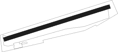
| Elevation | 810ft (247m) |
| Timezone | GMT +0 |
| Coordinates | 50.96722, -2.15361 |
| Magnetic var | |
| Type | land |
| Available since | X-Plane v10.40 |
| ICAO code | EGHA |
| IATA code | n/a |
| FAA code | n/a |
Communication
Nearby Points of Interest:
Ashcombe House
-Town Hall
-Westminster Memorial Hospital
-Shute House
-The Cobbler's Cottage
-Castle Rings
-Iron Age and Romano-British settlement remains on Woodcutts Common, 850m south east and 845m SSE of Arundell Cottages
-Eastbury Park
-All Saints Church
-Stepleton House
-Chettle House
-Alvediston Manor
-Pythouse
-Shillingstone Quarry
-St Mary's Church, Long Crichel
-East Knoyle War Memorial
-Castle Ditches
-Clouds House
-Fonthill Abbey
-Place Farmhouse
-Crichel House
-Bronze Age and Romano-British enclosure on Martin Down, east of Bokerley Junction
-St Giles House, Wimborne St Giles
-Reddish House
-Shanks House
Nearby beacons
| code | identifier | dist | bearing | frequency |
|---|---|---|---|---|
| BIA | BOURNEMOUTH NDB | 16.3 | 121° | 339 |
| VLN | YEOVILTON TACAN | 18.4 | 274° | 111 |
| BDN | BOSCOMBE DOWN TACAN | 18.6 | 66° | 108.20 |
| YVL | DME | 18.9 | 267° | 109.05 |
| YVL | YEOVIL NDB | 19.3 | 267° | 343 |
| EAS | SOUTHAMPTON (EASTLEIGH) NDB | 30.1 | 91° | 391 |
| SAM | SOUTHAMPTON VOR/DME | 30.5 | 91° | 113.35 |
| BRI | BRISTOL NDB | 32.7 | 306° | 414 |
| OF | FILTON NDB | 37.1 | 322° | 325 |
| FFA | FAIRFORD TACAN | 44.9 | 26° | 113.40 |
| CPT | COMPTON VOR/DME | 47.1 | 61° | 114.35 |
| BZN | BRIZE NORTON TACAN | 51.2 | 35° | 111.90 |
| BZ | BRIZE NORTON NDB | 51.3 | 35° | 386 |
| GST | GLOUCESTERSHIRE NDB | 55.5 | 359° | 331 |
| OX | OXFORD NDB | 60.6 | 44° | 367 |
Disclaimer
The information on this website is not for real aviation. Use this data with the X-Plane flight simulator only! Data taken with kind consent from X-Plane 12 source code and data files. Content is subject to change without notice.