Land's End
Airport details
| Country | United Kingdom |
| State | England |
| Region | EG |
| Airspace | London Ctr |
| Municipality | St Just |
| Elevation | 396ft (121m) |
| Timezone | GMT +0 |
| Coordinates | 50.10257, -5.66893 |
| Magnetic var | |
| Type | land |
| Available since | X-Plane v10.40 |
| ICAO code | EGHC |
| IATA code | LEQ |
| FAA code | n/a |
Communication
| Land's End Land's End Tower | 120.255 |
Nearby Points of Interest:
Lower Bostraze and Leswidden SSSI
-Botallack Manor House
-Standing stone known as the 'Blind Fiddler', 405m south east of Lesbew Farm
-Two standing stones known as the Long Stones, 280m south east of Higher Drift Farm
-Boleigh Fogou
-Trereife House
-Castle Horneck
-Aire Point to Carrick Du SSSI
-Treneere Manor
-Public Buildings
-Morrab Library
-Market Building, Penzance
-South Pier
-St Michael's Mount castle
-Marazion Marsh RSPB Reserve
-Acton Castle
-Penberthy Croft mine
-Cornwall and West Devon Mining Landscape
-The Bucket of Blood
-Wheal Trewavas
-Godrevy Head to St Agnes
-West Cornwall Bryophytes Site of Special Scientific Interest
-Mining Exchange
-Goonhilly Downs
-Caerthillian to Kennack
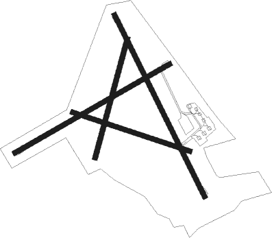
Runway info
Runway 07 / 25  | ||
| length | 691m (2267ft) | |
| bearing | 73° / 253° | |
| width | 18m (59ft) | |
| surface | asphalt | |
| displ threshold | 0m (0ft) / 59m (194ft) | |
| Runway 16 / 34 | ||
| length | 784m (2572ft) | |
| bearing | 148° / 328° | |
| width | 18m (59ft) | |
| surface | asphalt | |
| displ threshold | 101m (331ft) / 0m (0ft) | |
| Runway 02 / 20 | ||
| length | 476m (1562ft) | |
| bearing | 29° / 209° | |
| width | 19m (62ft) | |
| surface | grass | |
| displ threshold | 0m (0ft) / 28m (92ft) | |
| Runway 11 / 29 | ||
| length | 479m (1572ft) | |
| bearing | 105° / 285° | |
| width | 18m (59ft) | |
| surface | grass | |
| displ threshold | 60m (197ft) / 0m (0ft) | |
Nearby beacons
| code | identifier | dist | bearing | frequency |
|---|---|---|---|---|
| LND | LANDS END VOR/DME | 2.3 | 44° | 114.20 |
| CUL | CULDROSE NDB | 16.2 | 93° | 370 |
| STM | SCILLY ISLES NDB | 26.5 | 253° | 321 |
| NQY | NEWQUAY NDB | 32.9 | 63° | 347 |
Instrument approach procedures
| runway | airway (heading) | route (dist, bearing) |
|---|---|---|
| RW07 | BAVKI (92°) | BAVKI 2000ft SIVBO (4mi, 144°) 2000ft |
| RW07 | KOGOK (50°) | KOGOK 2000ft SIVBO (4mi, 324°) 2000ft |
| RNAV | SIVBO 2000ft HC07F (3mi, 73°) 2000ft EGHC (5mi, 74°) 397ft HCM07 (2mi, 71°) UMBOB (7mi, 310°) 2000ft UMBOB (turn) | |
| RW16 | APVOG (191°) | APVOG 2000ft UMBOB (4mi, 256°) 2000ft |
| RW16 | TUBNO (117°) | TUBNO 2000ft UMBOB (4mi, 76°) 2000ft |
| RNAV | UMBOB 2000ft HC16F (3mi, 148°) 2000ft EGHC (4mi, 147°) 423ft HCM16 (2mi, 150°) TUBNO (10mi, 303°) UMBOB (4mi, 76°) 2000ft UMBOB (turn) | |
| RW25 | DIBTO (223°) | DIBTO 2000ft NIDGA (4mi, 144°) 2000ft |
| RNAV | NIDGA 2000ft HC25F (3mi, 253°) 2000ft EGHC (3mi, 252°) 429ft HCM25 (2mi, 255°) UMBOB (8mi, 353°) 2000ft UMBOB (turn) | |
| RW34 | GESVI (12°) | GESVI 2000ft NUTMU (4mi, 76°) 2000ft |
| RNAV | NUTMU 2000ft HC34F (3mi, 328°) 2000ft EGHC (4mi, 329°) 426ft HCM34 (2mi, 326°) GESVI (10mi, 182°) NUTMU (4mi, 76°) 2000ft NUTMU (turn) |
Disclaimer
The information on this website is not for real aviation. Use this data with the X-Plane flight simulator only! Data taken with kind consent from X-Plane 12 source code and data files. Content is subject to change without notice.