Southampton
Airport details
| Country | United Kingdom |
| State | England |
| Region | EG |
| Airspace | London Ctr |
| Municipality | Eastleigh |
| Elevation | 41ft (12m) |
| Timezone | GMT +0 |
| Coordinates | 50.95026, -1.35680 |
| Magnetic var | |
| Type | land |
| Available since | X-Plane v10.40 |
| ICAO code | EGHI |
| IATA code | SOU |
| FAA code | n/a |
Communication
| Southampton Southampton Information | 130.880 |
| Southampton Southampton Tower | 118.205 |
| Southampton Southampton Approach | 120.230 |
Approach frequencies
| ILS-cat-I | RW20 | 110.75 | 18.00mi |
| 3.1° GS | RW20 | 110.75 | 18.00mi |
Nearby Points of Interest:
Townhill Park House
-South Stoneham House
-Hollybrook Cemetery
-Civic Centre
-Wyndham Court
-Southampton Terminus railway station
-King John's Palace
-Church of St Julien, Southampton
-King George V Dry Dock
-Grove Place House Northcliffe School
-Merdon Castle
-Sadler's Mill
-St Thomas Church, Winchester
-Winchester Guildhall
-St Maurice's Church, Winchester
-Castle Hill Offices County Hall
-Winchester city wall and associated monuments
-Chesapeake Mill
-Hyde Close drill hall
-St Mary's Church, Ashley
-Rookley House
-Kings Somborne War Memorial
-Fort Fareham
-Exbury Gardens
-Horsebridge railway station
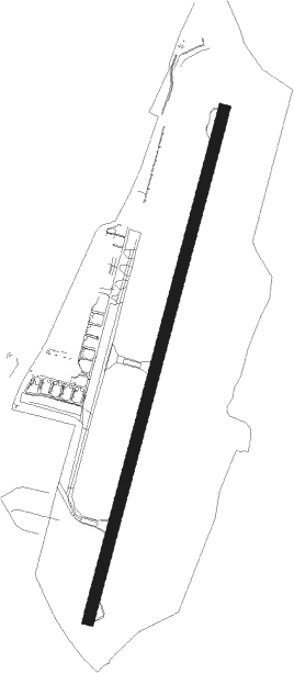
Runway info
| Runway 02 / 20 | ||
| length | 1722m (5650ft) | |
| bearing | 29° / 209° | |
| width | 37m (121ft) | |
| surface | asphalt | |
| displ threshold | 73m (240ft) / 44m (144ft) | |
| blast zone | 20m (66ft) / 0m (0ft) | |
Nearby beacons
| code | identifier | dist | bearing | frequency |
|---|---|---|---|---|
| EAS | SOUTHAMPTON (EASTLEIGH) NDB | 0.2 | 8° | 391 |
| SAM | SOUTHAMPTON VOR/DME | 0.5 | 67° | 113.35 |
| BDN | BOSCOMBE DOWN TACAN | 19.1 | 297° | 108.20 |
| BIA | BOURNEMOUTH NDB | 21.1 | 250° | 339 |
| ODH | ODIHAM TACAN | 22.9 | 55° | 109.60 |
| GWC | GOODWOOD VOR/DME | 23.4 | 99° | 114.75 |
| MID | MIDHURST VOR/DME | 28.3 | 82° | 114 |
| BLC | DME | 29.5 | 54° | 116.20 |
| BLK | BLACKBUSHE NDB | 29.5 | 54° | 328 |
| CPT | COMPTON VOR/DME | 32.9 | 14° | 114.35 |
| WOD | WOODLEY NDB | 35.1 | 44° | 352 |
| OCK | OCKHAM VOR/DME | 40.3 | 69° | 115.30 |
| BSO | BENSON TACAN | 41 | 21° | 110 |
| BUR | BURNHAM NDB | 42.6 | 50° | 421 |
| EPM | EPSOM NDB | 43.2 | 69° | 316 |
| LON | LONDON VOR/DME | 46.4 | 59° | 113.60 |
| FFA | FAIRFORD TACAN | 46.9 | 329° | 113.40 |
| BZ | BRIZE NORTON NDB | 48.8 | 343° | 386 |
| BZN | BRIZE NORTON TACAN | 48.8 | 343° | 111.90 |
| CHT | CHILTERN NDB | 51.2 | 51° | 277 |
| HEN | HENTON NDB | 53 | 35° | 433 |
| OX | OXFORD NDB | 53 | 2° | 367 |
| BNN | BOVINGDON VOR/DME | 55.5 | 46° | 113.75 |
| WCO | WESTCOTT NDB | 56.1 | 24° | 335 |
| GST | GLOUCESTERSHIRE NDB | 64.1 | 319° | 331 |
Departure and arrival routes
| Transition altitude | 6000ft |
| STAR starting points | distance | inbound heading | |
|---|---|---|---|
| ALL | |||
| THRE1S | 29.5 | 34° | |
| BUGU1S | 56.5 | 164° | |
| CPT1S | 32.9 | 194° | |
| COWL1S | 41.4 | 204° | |
| UMBU2S | 63.3 | 251° | |
| ELDA1S | 81.4 | 283° | |
Holding patterns
| STAR name | hold at | type | turn | heading* | altitude | leg | speed limit |
|---|---|---|---|---|---|---|---|
| BUGU1S | PEPIS | VHF | right | 184 (4)° | 7000ft - 10000ft | 1.0min timed | 210 |
| BUGU1S | SAM | NDB | right | 210 (30)° | 2000ft - 10000ft | 1.0min timed | 210 |
| COWL1S | PEPIS | VHF | right | 184 (4)° | 7000ft - 10000ft | 1.0min timed | 210 |
| COWL1S | SAM | NDB | right | 210 (30)° | 2000ft - 10000ft | 1.0min timed | 210 |
| CPT1S | PEPIS | VHF | right | 184 (4)° | 7000ft - 10000ft | 1.0min timed | 210 |
| CPT1S | SAM | NDB | right | 210 (30)° | 2000ft - 10000ft | 1.0min timed | 210 |
| ELDA1S | RUDMO | VHF | left | 96 (276)° | 8000ft - 11000ft | 1.0min timed | 210 |
| ELDA1S | SAM | NDB | right | 210 (30)° | 2000ft - 10000ft | 1.0min timed | 210 |
| THRE1S | NEDUL | VHF | right | 205 (25)° | 4000ft - 15000ft | DME 5.0mi | 210 |
| UMBU2S | PEPIS | VHF | right | 184 (4)° | 7000ft - 10000ft | 1.0min timed | 210 |
| UMBU2S | SAM | NDB | right | 210 (30)° | 2000ft - 10000ft | 1.0min timed | 210 |
| *) magnetic outbound (inbound) holding course | |||||||
Disclaimer
The information on this website is not for real aviation. Use this data with the X-Plane flight simulator only! Data taken with kind consent from X-Plane 12 source code and data files. Content is subject to change without notice.