Henstridge
Airport details
| Country | United Kingdom |
| State | England |
| Region | EG |
| Airspace | London Ctr |
| Municipality | South Somerset |
| Elevation | 180ft (55m) |
| Timezone | GMT +0 |
| Coordinates | 50.98833, -2.35867 |
| Magnetic var | |
| Type | land |
| Available since | X-Plane v10.40 |
| ICAO code | EGHS |
| IATA code | n/a |
| FAA code | n/a |
Communication
| Henstridge Henstridge Radio | 130.255 |
Nearby Points of Interest:
Horsington House
-Shanks House
-Laycock Railway Cutting
-Ven House
-All Saints Church
-The Church Room
-Stavordale Priory
-Westminster Memorial Hospital
-Woolston Manor Farmhouse, And Front Boundary Wall With Railings
-Town Hall
-Sherborne House, Dorset
-Kenwalch's Castle
-North Cadbury Court
-Church of St Peter
-Shillingstone Quarry
-Cogley Wood
-Castle Rings
-Hadspen house and garden
-Stepleton House
-Bruton railway cutting
-Godminster Lane Quarry and Railway Cutting
-Sparkford Wood
-Gants Mill
-Sexey's Hospital
-Bow Bridge, Plox
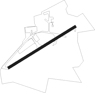
Runway info
| Runway 06 / 24 | ||
| length | 724m (2375ft) | |
| bearing | 72° / 252° | |
| width | 26m (85ft) | |
| surface | asphalt | |
Nearby beacons
| code | identifier | dist | bearing | frequency |
|---|---|---|---|---|
| VLN | YEOVILTON TACAN | 10.6 | 273° | 111 |
| YVL | DME | 11.5 | 261° | 109.05 |
| YVL | YEOVIL NDB | 11.9 | 261° | 343 |
| BIA | BOURNEMOUTH NDB | 23.2 | 112° | 339 |
| BDN | BOSCOMBE DOWN TACAN | 24.8 | 75° | 108.20 |
| BRI | BRISTOL NDB | 27.2 | 318° | 414 |
| OF | FILTON NDB | 33.1 | 336° | 325 |
| EX | EXETER NDB | 38.2 | 256° | 337 |
| CDF | CARDIFF NDB | 44.1 | 292° | 388 |
| FFA | FAIRFORD TACAN | 46.6 | 39° | 113.40 |
| BZN | BRIZE NORTON TACAN | 53.7 | 45° | 111.90 |
| BZ | BRIZE NORTON NDB | 53.8 | 45° | 386 |
| GST | GLOUCESTERSHIRE NDB | 54.7 | 12° | 331 |
| BCN | BRECON VOR/DME | 55.7 | 309° | 117.45 |
Disclaimer
The information on this website is not for real aviation. Use this data with the X-Plane flight simulator only! Data taken with kind consent from X-Plane 12 source code and data files. Content is subject to change without notice.