Challock
Airport details
| Country | United Kingdom |
| State | England |
| Region | EG |
| Airspace | London Ctr |
| Municipality | Ashford |
| Elevation | 600ft (183m) |
| Timezone | GMT +0 |
| Coordinates | 51.20833, 0.82917 |
| Magnetic var | |
| Type | land |
| Available since | X-Plane v10.40 |
| ICAO code | EGKE |
| IATA code | n/a |
| FAA code | n/a |
Communication
Nearby Points of Interest:
Jacket's Field Long Barrow
-Wye College
-Chilston Park
-Tithe Barn, Lenham
-Sharsted Court
-Boughton Place
-Julliberrie's Grave
-Copton Pumping Windmill
-The Old House, Harrietsham
-Provender
-Hatch Park
-Memorials to the victims of the 1916 Faversham Munitions Explosion
-Shrub's Wood Long Barrow
-The Guildhall
-Faversham Abbey
-Davington Priory
-Oare Windmill
-Lower Mill
-Hollingbourne Manor
-Leacon Hall
-Davison's Mill, Stelling Minnis
-Memorial to Christopher Marlowe
-Church of the Holy Cross
-Canterbury city walls
-Blackfriars
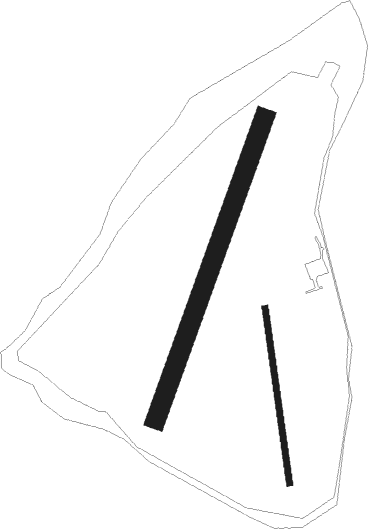
Runway info
Runway 18 / 36  | ||
| length | 363m (1191ft) | |
| bearing | 174° / 354° | |
| width | 12m (41ft) | |
| surface | grass | |
| Runway 2 / 20 | ||
| length | 658m (2159ft) | |
| bearing | 36° / 216° | |
| width | 40m (131ft) | |
| surface | grass | |
Nearby beacons
| code | identifier | dist | bearing | frequency |
|---|---|---|---|---|
| HLS | DME | 7.4 | 253° | 115.95 |
| LSH | HEADCORN (LASHENDEN) NDB | 7.4 | 253° | 340 |
| DET | DETLING VOR/DME | 10.4 | 292° | 117.30 |
| LYD | LYDD VOR/DME | 12.6 | 167° | 114.05 |
| LZD | LYDD NDB | 15.5 | 156° | 397 |
| DVR | DOVER VOR/DME | 20.1 | 95° | 114.95 |
| SND | SOUTHEND NDB | 22.6 | 341° | 362 |
| MAY | MAYFIELD VOR/DME | 29.2 | 255° | 117.90 |
| BIG | BIGGIN VOR/DME | 30.7 | 279° | 115.10 |
| LCY | LONDON CITY NDB | 33.6 | 291° | 322 |
| LAM | LAMBOURNE VOR/DME | 36.5 | 303° | 115.60 |
| SFD | SEAFORD VOR/DME | 37.9 | 238° | 117 |
| ING | SAINT INGLEVERT NDB | 39.6 | 110° | 387 |
| CLN | CLACTON VOR/DME | 40.2 | 26° | 114.55 |
| EPM | EPSOM NDB | 45.6 | 275° | 316 |
| BPK | BROOKMANS PARK VOR/DME | 47.7 | 300° | 117.50 |
| SRH | DME-ILS | 47.9 | 252° | 109.95 |
| SHM | SHOREHAM NDB | 48 | 252° | 332 |
| OCK | OCKHAM VOR/DME | 48.3 | 274° | 115.30 |
| LON | LONDON VOR/DME | 51.4 | 282° | 113.60 |
| BKY | BARKWAY VOR/DME | 54.9 | 316° | 116.25 |
| WTZ | WATTISHAM TACAN | 55 | 7° | 109.30 |
| MID | MIDHURST VOR/DME | 55.5 | 264° | 114 |
| CHT | CHILTERN NDB | 56.2 | 287° | 277 |
| LUT | LUTON NDB | 57.7 | 302° | 345 |
| BUR | BURNHAM NDB | 59.4 | 282° | 421 |
| BNN | BOVINGDON VOR/DME | 60.2 | 291° | 113.75 |
| BLC | DME | 63.2 | 274° | 116.20 |
| BLK | BLACKBUSHE NDB | 63.2 | 274° | 328 |
| GWC | GOODWOOD VOR/DME | 63.5 | 257° | 114.75 |
| WOD | WOODLEY NDB | 65.7 | 278° | 352 |
| ODH | ODIHAM TACAN | 66.8 | 271° | 109.60 |
| HEN | HENTON NDB | 69 | 289° | 433 |
Disclaimer
The information on this website is not for real aviation. Use this data with the X-Plane flight simulator only! Data taken with kind consent from X-Plane 12 source code and data files. Content is subject to change without notice.