Chalgrove
Airport details
| Country | United Kingdom |
| State | England |
| Region | EG |
| Airspace | London Ctr |
| Municipality | South Oxfordshire |
| Elevation | 235ft (72m) |
| Timezone | GMT +0 |
| Coordinates | 51.67445, -1.08528 |
| Magnetic var | |
| Type | land |
| Available since | X-Plane v10.40 |
| ICAO code | EGLJ |
| IATA code | n/a |
| FAA code | n/a |
Communication
| Chalgrove Chalgrove Radio | 125.400 |
Nearby Points of Interest:
Garsington Manor
-Brightwell Barrow
-Wallingford Bridge
-Nuneham House
-Carfax Conduit
-Carmel College
-Littlemore Hospital
-Town Hall
-South Moreton Castle
-St Johns Home
-Turville Grange
-Abingdon Abbey
-Cosener's House
-Abingdon Bridge
-Culham Manor
-The Abbey, Sutton Courtenay
-Manor House
-University College Boathouse
-Florey Building
-Woodperry House
-Notley Abbey
-Notley Farm dovecote
-Folly Bridge
-Radcliffe Quadrangle
-Holywell Manor, Oxford
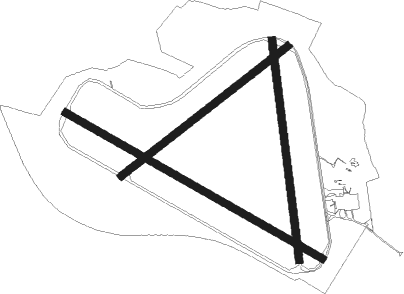
Runway info
Runway 13 / 31  | ||
| length | 1795m (5889ft) | |
| bearing | 113° / 293° | |
| width | 46m (151ft) | |
| surface | asphalt | |
| Runway 18 / 36 | ||
| length | 1343m (4406ft) | |
| bearing | 176° / 356° | |
| width | 46m (151ft) | |
| surface | asphalt | |
| displ threshold | 0m (0ft) / 123m (404ft) | |
| Runway 06 / 24 | ||
| length | 1282m (4206ft) | |
| bearing | 68° / 248° | |
| width | 46m (151ft) | |
| surface | asphalt | |
Nearby beacons
| code | identifier | dist | bearing | frequency |
|---|---|---|---|---|
| BSO | BENSON TACAN | 3.6 | 193° | 110 |
| WCO | WESTCOTT NDB | 11.6 | 35° | 335 |
| CPT | COMPTON VOR/DME | 12 | 216° | 114.35 |
| HEN | HENTON NDB | 12.1 | 74° | 433 |
| OX | OXFORD NDB | 13 | 304° | 367 |
| WOD | WOODLEY NDB | 15.3 | 137° | 352 |
| BUR | BURNHAM NDB | 17.8 | 111° | 421 |
| BZ | BRIZE NORTON NDB | 19.7 | 278° | 386 |
| BZN | BRIZE NORTON TACAN | 19.7 | 278° | 111.90 |
| BNN | BOVINGDON VOR/DME | 20.1 | 84° | 113.75 |
| CHT | CHILTERN NDB | 21.3 | 95° | 277 |
| BLC | DME | 22.9 | 146° | 116.20 |
| BLK | BLACKBUSHE NDB | 22.9 | 146° | 328 |
| LON | LONDON VOR/DME | 25.6 | 107° | 113.60 |
| FFA | FAIRFORD TACAN | 26.5 | 271° | 113.40 |
| ODH | ODIHAM TACAN | 27 | 163° | 109.60 |
| DTY | DAVENTRY VOR/DME | 30.3 | 357° | 116.40 |
| OCK | OCKHAM VOR/DME | 32.5 | 120° | 115.30 |
| CIT | CRANFIELD NDB | 33.6 | 49° | 850 |
| LUT | LUTON NDB | 33.6 | 75° | 345 |
| EPM | EPSOM NDB | 34.1 | 116° | 316 |
| BPK | BROOKMANS PARK VOR/DME | 36.6 | 86° | 117.50 |
| BDN | BOSCOMBE DOWN TACAN | 40.2 | 232° | 108.20 |
| MID | MIDHURST VOR/DME | 41 | 143° | 114 |
| SAM | SOUTHAMPTON VOR/DME | 44.2 | 200° | 113.35 |
| EAS | SOUTHAMPTON (EASTLEIGH) NDB | 44.3 | 201° | 391 |
| LAM | LAMBOURNE VOR/DME | 46.1 | 91° | 115.60 |
| HON | HONILEY VOR/DME | 46.2 | 320° | 113.65 |
| GWC | GOODWOOD VOR/DME | 50.7 | 158° | 114.75 |
| BHX | BIRMINGHAM NDB | 52.9 | 319° | 406 |
| LE | LEICESTER NDB | 56 | 3° | 383 |
| CAM | CAMBRIDGE NDB | 56.9 | 67° | 332 |
| SHM | SHOREHAM NDB | 58.4 | 137° | 332 |
| SRH | DME-ILS | 58.4 | 137° | 109.95 |
| MAY | MAYFIELD VOR/DME | 59.9 | 119° | 117.90 |
| WIT | WITTERING TACAN | 60 | 32° | 117.60 |
| BIA | BOURNEMOUTH NDB | 60.9 | 220° | 339 |
| DET | DETLING VOR/DME | 66.7 | 102° | 117.30 |
| SND | SOUTHEND NDB | 66.8 | 93° | 362 |
| SFD | SEAFORD VOR/DME | 71.2 | 127° | 117 |
| MLD | MILDENHALL TACAN | 71.3 | 66° | 115.90 |
| HLS | DME | 72.1 | 107° | 115.95 |
| LSH | HEADCORN (LASHENDEN) NDB | 72.1 | 107° | 340 |
| LKH | LAKENHEATH TACAN | 74.6 | 66° | 110.20 |
Disclaimer
The information on this website is not for real aviation. Use this data with the X-Plane flight simulator only! Data taken with kind consent from X-Plane 12 source code and data files. Content is subject to change without notice.