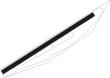
Beenham - Brimpton
Airport details
| Country | United Kingdom |
| State | England |
| Region | EG |
| Airspace | London Ctr |
| Municipality | West Berkshire |
| Elevation | 208ft (63m) |
| Timezone | GMT +0 |
| Coordinates | 51.38450, -1.16867 |
| Magnetic var | |
| Type | land |
| Available since | X-Plane v10.40 |
| ICAO code | EGLP |
| IATA code | n/a |
| FAA code | n/a |
Communication
Nearby Points of Interest:
Aldermaston Lock
-Ufton Court
-Monkey Marsh Lock
-Pamber Forest and Silchester Common
-Old Bluecoat School, Thatcham
-Folly Farmhouse And Entrance Court To East
-Calleva Atrebatum
-Brockhurst and Marlston House School
-Sheffield Lock
-Garston Lock
-Sandleford Priory
-Shaw House
-Town Hall And Municipal Buildings
-Donnington Hospital
-Sandham Memorial Chapel
-Whitchurch Bridge
-Stanford End Mill and River Loddon
-Perborough Castle
-Benham Park
-Bath Road Reservoir
-Hardwick House
-Chazey Court Barn
-Swallowfield Park
-Vachel Almshouses
-Broad Street Independent Chapel, Reading
Nearby beacons
| code | identifier | dist | bearing | frequency |
|---|---|---|---|---|
| CPT | COMPTON VOR/DME | 6.7 | 335° | 114.35 |
| WOD | WOODLEY NDB | 11.6 | 77° | 352 |
| ODH | ODIHAM TACAN | 12.2 | 125° | 109.60 |
| BLC | DME | 12.6 | 101° | 116.20 |
| BLK | BLACKBUSHE NDB | 12.6 | 101° | 328 |
| BSO | BENSON TACAN | 14 | 17° | 110 |
| BUR | BURNHAM NDB | 20 | 75° | 421 |
| BDN | BOSCOMBE DOWN TACAN | 26.1 | 248° | 108.20 |
| HEN | HENTON NDB | 26.5 | 45° | 433 |
| SAM | SOUTHAMPTON VOR/DME | 26.6 | 202° | 113.35 |
| EAS | SOUTHAMPTON (EASTLEIGH) NDB | 26.7 | 204° | 391 |
| LON | LONDON VOR/DME | 27 | 82° | 113.60 |
| BZ | BRIZE NORTON NDB | 27.2 | 310° | 386 |
| BZN | BRIZE NORTON TACAN | 27.2 | 310° | 111.90 |
| OCK | OCKHAM VOR/DME | 27.4 | 96° | 115.30 |
| OX | OXFORD NDB | 27.5 | 341° | 367 |
| CHT | CHILTERN NDB | 28.2 | 70° | 277 |
| MID | MIDHURST VOR/DME | 28.5 | 121° | 114 |
| WCO | WESTCOTT NDB | 29.1 | 24° | 335 |
| FFA | FAIRFORD TACAN | 29.5 | 295° | 113.40 |
| EPM | EPSOM NDB | 30.1 | 95° | 316 |
| BNN | BOVINGDON VOR/DME | 30.9 | 61° | 113.75 |
| GWC | GOODWOOD VOR/DME | 35.3 | 142° | 114.75 |
| BIA | BOURNEMOUTH NDB | 44.4 | 228° | 339 |
| LUT | LUTON NDB | 45.8 | 61° | 345 |
| SHM | SHOREHAM NDB | 46.5 | 122° | 332 |
| SRH | DME-ILS | 46.6 | 122° | 109.95 |
| DTY | DAVENTRY VOR/DME | 47.8 | 4° | 116.40 |
| GST | GLOUCESTERSHIRE NDB | 48.1 | 297° | 331 |
| CIT | CRANFIELD NDB | 50.2 | 39° | 850 |
| HON | HONILEY VOR/DME | 61.2 | 333° | 113.65 |
| DET | DETLING VOR/DME | 66.4 | 93° | 117.30 |
| HLS | DME | 69.7 | 97° | 115.95 |
| LSH | HEADCORN (LASHENDEN) NDB | 69.7 | 97° | 340 |
| CAM | CAMBRIDGE NDB | 70.5 | 59° | 332 |
| SND | SOUTHEND NDB | 70.8 | 84° | 362 |
Disclaimer
The information on this website is not for real aviation. Use this data with the X-Plane flight simulator only! Data taken with kind consent from X-Plane 12 source code and data files. Content is subject to change without notice.