Southend
Airport details
| Country | United Kingdom |
| State | England |
| Region | EG |
| Airspace | London Ctr |
| Municipality | Rochford |
| Elevation | 44ft (13m) |
| Timezone | GMT +0 |
| Coordinates | 51.57028, 0.69333 |
| Magnetic var | |
| Type | land |
| Available since | X-Plane v10.40 |
| ICAO code | EGMC |
| IATA code | SEN |
| FAA code | n/a |
Communication
| Southend Southend Information | 136.055 |
| Southend Southend Tower | 127.730 |
| Southend Southend Approach | 130.780 |
| Southend Southend Radar | 130.780 |
Approach frequencies
| ILS-cat-I | RW23 | 111.35 | 18.00mi |
| ILS-cat-I | RW05 | 111.35 | 18.00mi |
| 3.5° GS | RW05 | 111.35 | 18.00mi |
| 3° GS | RW23 | 111.35 | 18.00mi |
Nearby Points of Interest:
Cliff Town Congregational Church
-Southend-on-Sea War Memorial
-Hockley Spa Rooms
-Hockley Woods
-Kursaal
-Great Wood and Dodd's Grove
-HMS London
-Royal Corinthian Yacht Club
-Stow Maries Aerodrome
-Pitsea Marsh
-Grain Tower
-Great Mill
-Blackwater Estuary
-Queenborough Castle
-Danbury Common
-Danbury Place
-Stock Windmill
-Blake's Wood & Lingwood Common
-Cockham Wood Fort
-River Ter
-Aviators Memorial
-Dengie SPA
-Drill Hall Library
-Chatham Dockyard
-Royal Oak
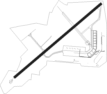
Runway info
| Runway 05 / 23 | ||
| length | 1849m (6066ft) | |
| bearing | 66° / 246° | |
| width | 37m (121ft) | |
| surface | asphalt | |
| displ threshold | 0m (0ft) / 248m (814ft) | |
| blast zone | 135m (443ft) / 0m (0ft) | |
Nearby beacons
| code | identifier | dist | bearing | frequency |
|---|---|---|---|---|
| SND | SOUTHEND NDB | 0.4 | 50° | 362 |
| DET | DETLING VOR/DME | 16.3 | 200° | 117.30 |
| LAM | LAMBOURNE VOR/DME | 20.7 | 278° | 115.60 |
| CLN | CLACTON VOR/DME | 23.7 | 59° | 114.55 |
| LCY | LONDON CITY NDB | 23.7 | 264° | 322 |
| HLS | DME | 25 | 186° | 115.95 |
| LSH | HEADCORN (LASHENDEN) NDB | 25 | 186° | 340 |
| BIG | BIGGIN VOR/DME | 28.5 | 250° | 115.10 |
| BPK | BROOKMANS PARK VOR/DME | 31.6 | 283° | 117.50 |
| WTZ | WATTISHAM TACAN | 34.3 | 24° | 109.30 |
| BKY | BARKWAY VOR/DME | 34.4 | 304° | 116.25 |
| DVR | DOVER VOR/DME | 34.9 | 121° | 114.95 |
| LYD | LYDD VOR/DME | 34.9 | 162° | 114.05 |
| LZD | LYDD NDB | 37.8 | 158° | 397 |
| MAY | MAYFIELD VOR/DME | 39.6 | 226° | 117.90 |
| LUT | LUTON NDB | 40.2 | 289° | 345 |
| EPM | EPSOM NDB | 42.6 | 257° | 316 |
| CAM | CAMBRIDGE NDB | 42.8 | 321° | 332 |
| LON | LONDON VOR/DME | 43.6 | 266° | 113.60 |
| CHT | CHILTERN NDB | 45.3 | 272° | 277 |
| OCK | OCKHAM VOR/DME | 45.5 | 257° | 115.30 |
| BNN | BOVINGDON VOR/DME | 47.2 | 277° | 113.75 |
| MLD | MILDENHALL TACAN | 48.2 | 346° | 115.90 |
| LKH | LAKENHEATH TACAN | 50.5 | 350° | 110.20 |
| BUR | BURNHAM NDB | 51.2 | 268° | 421 |
| SFD | SEAFORD VOR/DME | 53.1 | 215° | 117 |
| HEN | HENTON NDB | 56.4 | 277° | 433 |
| CIT | CRANFIELD NDB | 57.2 | 294° | 850 |
| SRH | DME-ILS | 57.6 | 233° | 109.95 |
| SHM | SHOREHAM NDB | 57.7 | 233° | 332 |
| MID | MIDHURST VOR/DME | 58.4 | 249° | 114 |
| WOD | WOODLEY NDB | 59.1 | 266° | 352 |
| BLC | DME | 59.4 | 261° | 116.20 |
| BLK | BLACKBUSHE NDB | 59.4 | 261° | 328 |
| WCO | WESTCOTT NDB | 63.9 | 280° | 335 |
| ODH | ODIHAM TACAN | 64.7 | 258° | 109.60 |
| BSO | BENSON TACAN | 66.9 | 271° | 110 |
| GWC | GOODWOOD VOR/DME | 69.4 | 244° | 114.75 |
| CPT | COMPTON VOR/DME | 71.6 | 268° | 114.35 |
Departure and arrival routes
| Transition altitude | 6000ft |
| STAR starting points | distance | inbound heading | |
|---|---|---|---|
| ALL | |||
| NEVI1S | 102.5 | 34° | |
| KATH1S | 99.1 | 63° | |
| SAM1S | 85.0 | 73° | |
| SILV1S | 65.3 | 99° | |
| FINM1S | 69.7 | 104° | |
| LIST1S | 142.0 | 119° | |
| XAMA1S | 58.4 | 262° | |
| SUMU1S | 52.9 | 267° | |
| SOVA1S | 55.7 | 316° | |
Holding patterns
| STAR name | hold at | type | turn | heading* | altitude | leg | speed limit |
|---|---|---|---|---|---|---|---|
| FINM1S | BOMBO | VHF | left | 271 (91)° | < 14000ft | DME 5.0mi | 220 |
| FINM1S | SPEAR | VHF | right | 13 (193)° | 4000ft - 7000ft | DME 3.2mi | 195 |
| KATH1S | GEGMU | VHF | right | 83 (263)° | 4000ft - 6000ft | 1.0min timed | 195 |
| KATH1S | OKVAP | VHF | left | 181 (1)° | 13000ft - 15000ft | 1.0min timed | 220 |
| LIST1S | BOMBO | VHF | left | 271 (91)° | < 14000ft | DME 5.0mi | 220 |
| LIST1S | SPEAR | VHF | right | 13 (193)° | 4000ft - 7000ft | DME 3.2mi | 195 |
| NEVI1S | GEGMU | VHF | right | 83 (263)° | 4000ft - 6000ft | 1.0min timed | 195 |
| NEVI1S | OKVAP | VHF | left | 181 (1)° | 13000ft - 15000ft | 1.0min timed | 220 |
| SAM1S | GEGMU | VHF | right | 83 (263)° | 4000ft - 6000ft | 1.0min timed | 195 |
| SAM1S | OKVAP | VHF | left | 181 (1)° | 13000ft - 15000ft | 1.0min timed | 220 |
| SILV1S | BOMBO | VHF | left | 271 (91)° | < 14000ft | DME 5.0mi | 220 |
| SILV1S | SPEAR | VHF | right | 13 (193)° | 4000ft - 7000ft | DME 3.2mi | 195 |
| SOVA1S | GEGMU | VHF | right | 83 (263)° | 4000ft - 6000ft | 1.0min timed | 195 |
| SOVA1S | OKVAP | VHF | left | 181 (1)° | 13000ft - 15000ft | 1.0min timed | 220 |
| SUMU1S | GEGMU | VHF | right | 83 (263)° | 4000ft - 6000ft | 1.0min timed | 195 |
| SUMU1S | JACKO | VHF | left | 84 (264)° | 8000ft - 14000ft | 1.0min timed | 210 |
| XAMA1S | GEGMU | VHF | right | 83 (263)° | 4000ft - 6000ft | 1.0min timed | 195 |
| XAMA1S | JACKO | VHF | left | 84 (264)° | 8000ft - 14000ft | 1.0min timed | 210 |
| *) magnetic outbound (inbound) holding course | |||||||
Disclaimer
The information on this website is not for real aviation. Use this data with the X-Plane flight simulator only! Data taken with kind consent from X-Plane 12 source code and data files. Content is subject to change without notice.