Worksop - Netherthorpe
Airport details
| Country | United Kingdom |
| State | England |
| Region | EG |
| Airspace | London Ctr |
| Municipality | Rotherham |
| Elevation | 250ft (76m) |
| Timezone | GMT +0 |
| Coordinates | 53.31694, -1.19639 |
| Magnetic var | |
| Type | land |
| Available since | X-Plane v10.40 |
| ICAO code | EGNF |
| IATA code | n/a |
| FAA code | n/a |
Communication
| Netherthorpe Netherthorpe Radio | 123.275 |
Nearby Points of Interest:
Shireoaks Hall
-Lindrick Golf Club
-Worksop Manor
-Worksop Town Hall
-St John's Church, Throapham
-Hodsock Priory
-Cuckney Castle
-Renishaw Hall
-Sandbeck Park
-Blyth Priory
-Cross Daggers
-Barrow Hill Engine Shed
-Serlby Hall
-St John The Evangelist Church, Ridgeway
-Litfield Farmhouse And Attached Outbuildings To West
-Chapel At Intake Cemetery
-Herdings Community Centre
-Holy Trinity Hospital (Almshouses)
-Pleasley Colliery
-Town Hall
-Sloswicke's Hospital
-Don Bridge
-Boughton Pumping Station
-Darnall Works
-Wadworth Hall
Runway info
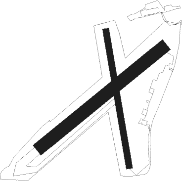
Runway 06 / 24  | ||
| length | 441m (1447ft) | |
| bearing | 68° / 248° | |
| width | 36m (118ft) | |
| surface | grass | |
| displ threshold | 31m (102ft) / 77m (253ft) | |
| Runway 18 / 36 | ||
| length | 387m (1270ft) | |
| bearing | 171° / 351° | |
| width | 18m (59ft) | |
| surface | grass | |
| displ threshold | 27m (89ft) / 71m (233ft) | |
Nearby beacons
| code | identifier | dist | bearing | frequency |
|---|---|---|---|---|
| GAM | GAMSTON VOR/DME | 9.1 | 98° | 112.80 |
| FNY | DONCASTER SHEFFIELD NDB | 11.7 | 51° | 338 |
| TNT | TRENT VOR/DME | 23.2 | 241° | 115.70 |
| WAD | WADDINGTON TACAN | 25.7 | 103° | 117.10 |
| SBL | SHERBURN-IN-ELMET NDB | 28.3 | 359° | 323 |
| EME | EAST MIDLANDS NDB | 29 | 180° | 353 |
| EMW | EAST MIDLANDS NDB | 30.7 | 208° | 393 |
| CWL | CRANWELL NDB | 30.8 | 112° | 423 |
| CWZ | CRANWELL TACAN | 30.8 | 112° | 117.40 |
| KIM | HUMBERSIDE NDB | 33.8 | 73° | 365 |
| TNL | TATENHILL NDB | 36.5 | 229° | 327 |
| LBA | LEEDS BRADFORD NDB | 36.7 | 320° | 402 |
| POL | POLE HILL VOR/DME | 41.2 | 295° | 112.10 |
| LE | LEICESTER NDB | 43 | 167° | 383 |
| WIT | WITTERING TACAN | 49.4 | 135° | 117.60 |
| BHX | BIRMINGHAM NDB | 55.5 | 213° | 406 |
| LEE | LEEMING TACAN | 60 | 341° | 112.60 |
| HON | HONILEY VOR/DME | 60.1 | 206° | 113.65 |
Disclaimer
The information on this website is not for real aviation. Use this data with the X-Plane flight simulator only! Data taken with kind consent from X-Plane 12 source code and data files. Content is subject to change without notice.