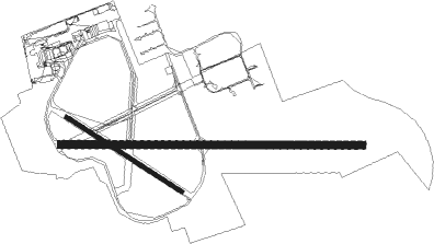
Blackpool
Airport details
| Country | United Kingdom |
| State | England |
| Region | EG |
| Airspace | London Ctr |
| Municipality | Borough of Fylde |
| Elevation | 34ft (10m) |
| Timezone | GMT +0 |
| Coordinates | 53.77167, -3.02861 |
| Magnetic var | |
| Type | land |
| Available since | X-Plane v10.40 |
| ICAO code | EGNH |
| IATA code | BLK |
| FAA code | n/a |
Communication
| Blackpool Blackpool Information | 127.200 |
| Blackpool Blackpool Tower | 119.950 |
| Blackpool Blackpool Approach | 119.950 |
Approach frequencies
| ILS-cat-I | RW28 | 108.15 | 18.00mi |
| 3° GS | RW28 | 108.15 | 18.00mi |
Nearby Points of Interest:
St Anne's Public Offices
-St Anne's Pier
-Lifeboat Monument, St Annes
-St Anne's Library
-Elmslie School
-Lifeboat Memorial, Lytham
-Empress Ballroom
-Opera House Theatre, Blackpool
-Blackpool Town Hall
-North Pier
-Ribble and Alt Estuaries
-Miners' Convalescent Home
-Ivy House
-Malt Kiln Farmhouse
-Raikes Farmhouse
-Greaves Hall
-Southport Promenade Hospital
-Southport Pier
-Meols Hall
-St George's Church, Southport
-Monumental Obelisk, Southport
-Southport War Memorial
-Wayfarers Arcade
-Southport Town Hall
-The Atkinson

Nearby beacons
| code | identifier | dist | bearing | frequency |
|---|---|---|---|---|
| BPL | BLACKPOOL NDB | 0 | 24° | 318 |
| WTN | WARTON TACAN | 5.4 | 102° | 113.20 |
| WTN | WARTON NDB | 6.3 | 96° | 337 |
| WL | BARROW (WALNEY ISLAND) NDB | 22.9 | 326° | 385 |
| WAL | WALLASEY VOR/DME | 23.1 | 196° | 114.10 |
| LPL | LIVERPOOL NDB | 28.1 | 145° | 349 |
| POL | POLE HILL VOR/DME | 32.8 | 92° | 112.10 |
| HAW | HAWARDEN NDB | 35.6 | 175° | 340 |
| MCT | MANCHESTER VOR/DME | 36.9 | 118° | 113.55 |
| WHI | WHITEGATE NDB | 38.1 | 145° | 368 |
| DCS | CROSS DME | 58.1 | 342° | 115.20 |
| DUF | DUN FELL DME | 58.3 | 32° | 115.25 |
| SWB | SHAWBURY VOR/DME | 59.9 | 159° | 116.80 |
Instrument approach procedures
| runway | airway (heading) | route (dist, bearing) |
|---|---|---|
| RW28 | MIFKO (273°) | MIFKO 3500ft NH28I (5mi, 273°) 2600ft |
| RW28 | ROBLU (288°) | ROBLU 3500ft NH28I (5mi, 8°) 2600ft |
| RW28 | TOVEL (259°) | TOVEL 3500ft NH28I (5mi, 188°) 2600ft |
| RNAV | NH28I 2600ft NH28F (5mi, 273°) 2000ft EGNH (6mi, 273°) 83ft (3233mi, 177°) 2000ft BPL (3233mi, 357°) 2000ft |
Disclaimer
The information on this website is not for real aviation. Use this data with the X-Plane flight simulator only! Data taken with kind consent from X-Plane 12 source code and data files. Content is subject to change without notice.