Skegness
Airport details
| Country | United Kingdom |
| State | England |
| Region | |
| Airspace | London Ctr |
| Municipality | East Lindsey |
| Elevation | 8ft (2m) |
| Timezone | GMT +0 |
| Coordinates | 53.17323, 0.31951 |
| Magnetic var | |
| Type | land |
| Available since | X-Plane v10.40 |
| ICAO code | EGNI |
| IATA code | n/a |
| FAA code | n/a |
Communication
| Skegness Skegness Radio | 132.425 |
Nearby Points of Interest:
Dobson's Windmill
-Hanby Hall
-Gunby Hall
-Chapel at Raithby Hall
-Somersby Grange
-All Saints Church, Theddlethorpe
-Revesby Abbey
-Bowl barrow cemetery on Bully Hill
-Scrivelsby Court
-Hunstanton Hall Moat Bridge And Garden And Forecourt Walls
-The Wash
-Town Hall
-Louth railway station
-Lincolnshire Wolds
-Dogdyke Engine
-Burnham Overy Staithe Windmill
-Burnham Westgate Hall
-Burnham Norton Friary
-The Old King's Head
-Union Mills, Burnham Overy
-Grim’s Mound
-Iron Age fort 900m north east of Dale Hole Cottage
-Wolferton railway station
-West Bank Lighthouse
-East Bank Lighthouse
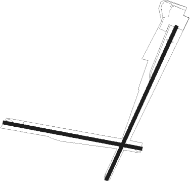
Runway info
Runway 10 / 28  | ||
| length | 776m (2546ft) | |
| bearing | 99° / 279° | |
| width | 20m (66ft) | |
| surface | grass | |
| Runway 3 / 21 | ||
| length | 932m (3058ft) | |
| bearing | 43° / 223° | |
| width | 20m (66ft) | |
| surface | grass | |
Nearby beacons
| code | identifier | dist | bearing | frequency |
|---|---|---|---|---|
| CGY | CONINGSBY TACAN | 18.2 | 260° | 111.10 |
| CWZ | CRANWELL TACAN | 30.2 | 260° | 117.40 |
| CWL | CRANWELL NDB | 30.4 | 260° | 423 |
| WAD | WADDINGTON TACAN | 30.4 | 269° | 117.10 |
| MAM | MARHAM TACAN | 32.7 | 155° | 108.70 |
| KIM | HUMBERSIDE NDB | 34 | 301° | 365 |
| OTR | OTTRINGHAM VOR/DME | 34.9 | 321° | 113.90 |
| WIT | WITTERING TACAN | 45 | 235° | 117.60 |
| GAM | GAMSTON VOR/DME | 46 | 275° | 112.80 |
| NWI | NORWICH NDB | 46 | 117° | 342 |
| LKH | LAKENHEATH TACAN | 46.7 | 163° | 110.20 |
| MLD | MILDENHALL TACAN | 49 | 168° | 115.90 |
| FNY | DONCASTER SHEFFIELD NDB | 50.7 | 283° | 338 |
| CAM | CAMBRIDGE NDB | 58 | 188° | 332 |
| EME | EAST MIDLANDS NDB | 58.4 | 257° | 353 |
| LE | LEICESTER NDB | 59.7 | 247° | 383 |
| SBL | SHERBURN-IN-ELMET NDB | 65.9 | 292° | 323 |
Disclaimer
The information on this website is not for real aviation. Use this data with the X-Plane flight simulator only! Data taken with kind consent from X-Plane 12 source code and data files. Content is subject to change without notice.