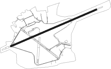
Warton - Warton Aerodrome
Airport details
| Country | United Kingdom |
| State | England |
| Region | EG |
| Airspace | London Ctr |
| Municipality | Borough of Fylde |
| Elevation | 55ft (17m) |
| Timezone | GMT +0 |
| Coordinates | 53.74510, -2.88306 |
| Magnetic var | |
| Type | land |
| Available since | X-Plane v10.40 |
| ICAO code | EGNO |
| IATA code | n/a |
| FAA code | n/a |
Communication
| Warton Aerodrome Warton Terminal Information | 121.730 |
| Warton Aerodrome Warton Tower | 130.805 |
| Warton Aerodrome Warton Approach | 129.530 |
Approach frequencies
| ILS-cat-I | RW25 | 109.9 | 18.00mi |
| 3° GS | RW25 | 109.9 | 18.00mi |
Nearby beacons
| code | identifier | dist | bearing | frequency |
|---|---|---|---|---|
| WTN | WARTON TACAN | 0.2 | 212° | 113.20 |
| WTN | WARTON NDB | 1.1 | 78° | 337 |
| BPL | BLACKPOOL NDB | 5.4 | 281° | 318 |
| WAL | WALLASEY VOR/DME | 23 | 215° | 114.10 |
| LPL | LIVERPOOL NDB | 24.9 | 159° | 349 |
| WL | BARROW (WALNEY ISLAND) NDB | 26.6 | 315° | 385 |
| POL | POLE HILL VOR/DME | 27.6 | 90° | 112.10 |
| MCT | MANCHESTER VOR/DME | 32.1 | 122° | 113.55 |
| HAW | HAWARDEN NDB | 34.1 | 190° | 340 |
| WHI | WHITEGATE NDB | 34.9 | 155° | 368 |
| SWB | SHAWBURY VOR/DME | 57.4 | 167° | 116.80 |
| DUF | DUN FELL DME | 58.3 | 25° | 115.25 |
| DCS | CROSS DME | 60.8 | 335° | 115.20 |
Disclaimer
The information on this website is not for real aviation. Use this data with the X-Plane flight simulator only! Data taken with kind consent from X-Plane 12 source code and data files. Content is subject to change without notice.
