Newcastle
Airport details
| Country | United Kingdom |
| State | England |
| Region | EG |
| Airspace | Scottish Ctr |
| Municipality | Newcastle upon Tyne |
| Elevation | 266ft (81m) |
| Timezone | GMT +0 |
| Coordinates | 55.03446, -1.69461 |
| Magnetic var | |
| Type | land |
| Available since | X-Plane v10.40 |
| ICAO code | EGNT |
| IATA code | NCL |
| FAA code | n/a |
Communication
| Newcastle ATIS | 118.380 |
| Newcastle Ground Control | 121.730 |
| Newcastle Tower | 119.705 |
| Newcastle Approach | 124.380 |
Approach frequencies
| ILS-cat-III | RW07 | 111.5 | 18.00mi |
| ILS-cat-III | RW25 | 111.5 | 18.00mi |
| 3° GS | RW07 | 111.5 | 18.00mi |
| 3° GS | RW25 | 111.5 | 18.00mi |
Nearby Points of Interest:
Woolsington Hall
-Sacred Heart Church, North Gosforth
-St Nicholas Hospital, Newcastle upon Tyne
-Blagdon Hall
-Battle of Newburn
-Temple of Antenociticus
-The Mitre
-Dissington Hall
-Newcastle University Students' Union
-Newcastle Civic Centre
-Leazes Park Synagogue
-Northumberland Baths/City Hall
-Army Riding School
-Burt Hall
-Newcastle Odeon
-Central Arcade
-Literary and Philosophical Society of Newcastle upon Tyne
-Milbourne Hall
-County Hall
-All Saints' Church, Newcastle upon Tyne
-Axwell House
-Moot Hall
-Bessie Surtees House
-Guildhall, Newcastle upon Tyne
-Customs House
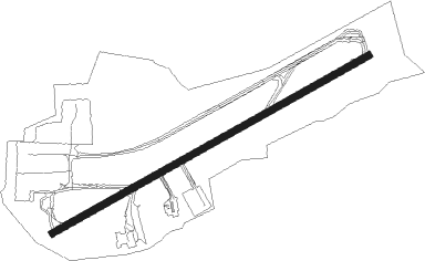
Runway info
| Runway 07 / 25 | ||
| length | 2323m (7621ft) | |
| bearing | 75° / 255° | |
| width | 46m (151ft) | |
| surface | concrete | |
| displ threshold | 120m (394ft) / 136m (446ft) | |
| blast zone | 33m (108ft) / 17m (56ft) | |
Nearby beacons
| code | identifier | dist | bearing | frequency |
|---|---|---|---|---|
| NEW | DME | 0.2 | 317° | 114.25 |
| NT | NEWCASTLE NDB | 2 | 73° | 352 |
| TD | TEESSIDE INTL NDB | 31 | 143° | 347 |
| DUF | DUN FELL DME | 33.5 | 245° | 115.25 |
| LEE | LEEMING TACAN | 44.6 | 168° | 112.60 |
| SAB | SAINT ABBS VOR/DME | 55.2 | 330° | 112.50 |
Departure and arrival routes
| Transition altitude | 6000ft |
| SID end points | distance | outbound heading | |
|---|---|---|---|
| RW07 | |||
| GIRL1T | 20mi | 199° | |
| RW25 | |||
| GIRL1Y, GIRL3X | 20mi | 199° | |
| STAR starting points | distance | inbound heading | |
|---|---|---|---|
| ALL | |||
| POL1N | 78.8 | 18° | |
| RIMT1N | 79.6 | 349° | |
| RW07 | |||
| ETSE1J | 20.1 | 359° | |
| RW25 | |||
| ETSE1K | 20.1 | 359° | |
Instrument approach procedures
| runway | airway (heading) | route (dist, bearing) |
|---|---|---|
| RW07 | ERUXI (54°) | ERUXI 5500ft NTW04 (6mi, 359°) 3500ft NT07I (2mi, 31°) 2600ft |
| RW07 | KUSEG (92°) | KUSEG 4000ft NT07I (5mi, 141°) 2600ft |
| RNAV | NT07I 2600ft NT07F (4mi, 75°) 2000ft EGNT (6mi, 76°) 314ft NTM01 (5mi, 74°) 2000ft (3308mi, 178°) 2000ft | |
| RW25 | ASGEB (234°) | ASGEB 4000ft SUPIG (5mi, 141°) 2600ft |
| RW25 | UPMOP (272°) | UPMOP 4000ft SUPIG (5mi, 321°) 2600ft |
| RNAV | SUPIG 2600ft NT25F (4mi, 255°) 2000ft EGNT (6mi, 254°) 290ft NTM02 (3mi, 256°) 2500ft (3305mi, 178°) 2500ft |
Holding patterns
| STAR name | hold at | type | turn | heading* | altitude | leg | speed limit |
|---|---|---|---|---|---|---|---|
| POL1N | ETSES | VHF | left | 191 (11)° | 9000ft - 11000ft | 1.0min timed | 220 |
| RIMT1N | ETSES | VHF | left | 191 (11)° | 9000ft - 11000ft | 1.0min timed | 220 |
| *) magnetic outbound (inbound) holding course | |||||||
Disclaimer
The information on this website is not for real aviation. Use this data with the X-Plane flight simulator only! Data taken with kind consent from X-Plane 12 source code and data files. Content is subject to change without notice.