Full Sutton
Airport details
| Country | United Kingdom |
| State | England |
| Region | EG |
| Airspace | London Ctr |
| Municipality | East Riding of Yorkshire |
| Elevation | 84ft (26m) |
| Timezone | GMT +0 |
| Coordinates | 53.98050, -0.86467 |
| Magnetic var | |
| Type | land |
| Available since | X-Plane v10.40 |
| ICAO code | EGNU |
| IATA code | n/a |
| FAA code | n/a |
Communication
| Full Sutton Full Sutton Radio | 120.100 |
Nearby Points of Interest:
Fangfoss railway station
-Stamford Bridge railway station
-Aldby Park
-Howsham Hall
-Derwent Ings
-Heslington Church
-Birdsall House
-Langwith College
-More House
-Ss Mary & Everilda, Everingham
-St Anthony's Hall
-Merchant Taylors' Hall, York
-Peaseholme House
-30 and 32 Goodramgate and 11 and 12 College Street
-41, 43 And 45, Goodramgate
-The Anglers Arms And Attached Buildings At Rear
-The Wealden Hall
-The Blue Bell
-Female Prison, York
-Lady Row
-Grays Court, York
-golden fleece york
-The Herbert House
-73, 75 And 77, Low Petergate
-Old Palace
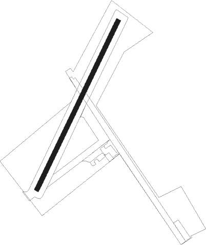
Runway info
| Runway 04 / 22 | ||
| length | 760m (2493ft) | |
| bearing | 45° / 225° | |
| width | 19m (62ft) | |
| surface | grass | |
| displ threshold | 0m (0ft) / 39m (128ft) | |
Nearby beacons
| code | identifier | dist | bearing | frequency |
|---|---|---|---|---|
| SBL | SHERBURN-IN-ELMET NDB | 16.7 | 241° | 323 |
| LBA | LEEDS BRADFORD NDB | 28.7 | 262° | 402 |
| LEE | LEEMING TACAN | 30.3 | 295° | 112.60 |
| KIM | HUMBERSIDE NDB | 30.4 | 129° | 365 |
| FNY | DONCASTER SHEFFIELD NDB | 30.7 | 195° | 338 |
| OTR | OTTRINGHAM VOR/DME | 31.8 | 110° | 113.90 |
| TD | TEESSIDE INTL NDB | 38.5 | 321° | 347 |
| GAM | GAMSTON VOR/DME | 42 | 187° | 112.80 |
| WAD | WADDINGTON TACAN | 50.4 | 157° | 117.10 |
| CWZ | CRANWELL TACAN | 58.7 | 158° | 117.40 |
| CWL | CRANWELL NDB | 58.8 | 159° | 423 |
| CGY | CONINGSBY TACAN | 58.9 | 142° | 111.10 |
| TNT | TRENT VOR/DME | 62.6 | 221° | 115.70 |
Disclaimer
The information on this website is not for real aviation. Use this data with the X-Plane flight simulator only! Data taken with kind consent from X-Plane 12 source code and data files. Content is subject to change without notice.