Shawbury - Raf Shawbury
Airport details
| Country | United Kingdom |
| State | England |
| Region | EG |
| Airspace | London Ctr |
| Municipality | Shawbury |
| Elevation | 248ft (76m) |
| Timezone | GMT +0 |
| Coordinates | 52.79606, -2.66386 |
| Magnetic var | |
| Type | land |
| Available since | X-Plane v10.40 |
| ICAO code | EGOS |
| IATA code | n/a |
| FAA code | n/a |
Communication
| RAF Shawbury Shawbury Director | 123.300 |
| RAF Shawbury Shawbury Tower | 122.100 |
| RAF Shawbury Shawbury Approach | 133.150 |
| RAF Shawbury Shawbury Departure | 122.100 |
| RAF Shawbury Shawbury Zone | 133.150 |
Approach frequencies
| ILS-cat-I | RW18 | 110.75 | 18.00mi |
| 3° GS | RW18 | 110.75 | 18.00mi |
Nearby Points of Interest:
Acton Reynald Hall
-Bury Walls
-High Ercall Hall
-Battle of Shrewsbury
-St Martin's Church, Preston Gubbals
-Albrighton Hall
-Peplow Hall
-Longdon-Upon-Tern aqueduct
-HM Prison Shrewsbury
-The Mount
-Newport House
-Welsh Bridge
-Longner Hall
-Attingham Park
-Cronkhill
-Buntingsdale Hall
-Styche Hall
-Pell Wall Hall
-Condover Hall
-Talbot Chapel
-Llyn Bedydd
-Sutherland Monument
-St Peter and Paul Church, Newport
-Churton Memorial Fountain
-Puleston Cross
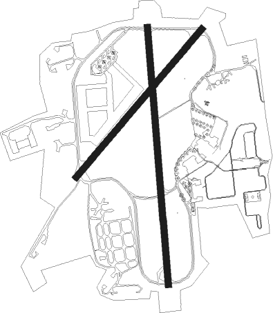
Runway info
Runway 18 / 36  | ||
| length | 1830m (6004ft) | |
| bearing | 180° / 360° | |
| width | 46m (151ft) | |
| surface | asphalt | |
| Runway 05 / 23 | ||
| length | 1373m (4505ft) | |
| bearing | 59° / 239° | |
| width | 46m (151ft) | |
| surface | asphalt | |
Nearby beacons
| code | identifier | dist | bearing | frequency |
|---|---|---|---|---|
| SWB | SHAWBURY VOR/DME | 0.1 | 38° | 116.80 |
| WPL | WELSHPOOL NDB | 20.4 | 251° | 323 |
| WBA | WOLVERHAMPTON NDB | 22.3 | 125° | 356 |
| WOL | DME | 22.3 | 125° | 108.60 |
| WHI | WHITEGATE NDB | 23.3 | 6° | 368 |
| HAW | HAWARDEN NDB | 25.6 | 321° | 340 |
| TNL | TATENHILL NDB | 32.5 | 89° | 327 |
| LPL | LIVERPOOL NDB | 32.7 | 354° | 349 |
| SH | SHOBDON NDB | 34.1 | 201° | 426 |
| MCT | MANCHESTER VOR/DME | 36.6 | 36° | 113.55 |
| BHX | BIRMINGHAM NDB | 39 | 111° | 406 |
| TNT | TRENT VOR/DME | 39.1 | 75° | 115.70 |
| WAL | WALLASEY VOR/DME | 39.6 | 322° | 114.10 |
| GST | GLOUCESTERSHIRE NDB | 57.2 | 151° | 331 |
| WTN | WARTON TACAN | 57.3 | 347° | 113.20 |
| WTN | WARTON NDB | 57.7 | 349° | 337 |
| BPL | BLACKPOOL NDB | 60.1 | 340° | 318 |
| POL | POLE HILL VOR/DME | 60.3 | 31° | 112.10 |
Disclaimer
The information on this website is not for real aviation. Use this data with the X-Plane flight simulator only! Data taken with kind consent from X-Plane 12 source code and data files. Content is subject to change without notice.