Lerwick Shetland Islands - Sumburgh
Airport details
| Country | United Kingdom |
| State | Scotland |
| Region | EG |
| Airspace | Scottish Ctr |
| Municipality | Shetland |
| Elevation | 20ft (6m) |
| Timezone | GMT +0 |
| Coordinates | 59.88139, -1.29389 |
| Magnetic var | |
| Type | land |
| Available since | X-Plane v10.40 |
| ICAO code | EGPB |
| IATA code | LSI |
| FAA code | n/a |
Communication
| Sumburgh Sumburgh Information | 125.855 |
| Sumburgh Sumburgh Tower | 118.255 |
| Sumburgh Sumburgh Radar | 131.300 |
Approach frequencies
| LOC | RW09 | 108.5 | 18.00mi |
| ILS-cat-I | RW27 | 108.5 | 18.00mi |
| 3° GS | RW27 | 108.5 | 18.00mi |
Nearby Points of Interest:
Sumburgh Head
-Lochs of Spiggie and Brow
-Catpund
-Bressay, South Road, The Glebe
-Lerwick Town Hall
-Maryfield House, including boundary walls and gatepiers
-Gardie House
-Tingwall, St Magnus's Church And Churchyard
-Böd of Gremista
-Hill of Cruester, standing stone 570m NE of Hiltoun
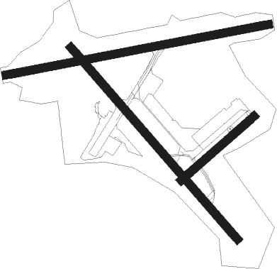
Runway info
Runway 09 / 27  | ||
| length | 1497m (4911ft) | |
| bearing | 87° / 267° | |
| width | 45m (148ft) | |
| surface | asphalt | |
| displ threshold | 105m (344ft) / 90m (295ft) | |
| Runway 15 / 33 | ||
| length | 1421m (4662ft) | |
| bearing | 124° / 304° | |
| width | 46m (151ft) | |
| surface | asphalt | |
| displ threshold | 187m (614ft) / 191m (627ft) | |
| Runway 06 / 24 | ||
| length | 542m (1778ft) | |
| bearing | 70° / 250° | |
| width | 45m (148ft) | |
| surface | asphalt | |
Nearby beacons
| code | identifier | dist | bearing | frequency |
|---|---|---|---|---|
| SBH | SUMBURGH NDB | 0 | 316° | 351 |
| SUM | SUMBURGH VOR/DME | 0.2 | 110° | 117.35 |
Instrument approach procedures
| runway | airway (heading) | route (dist, bearing) |
|---|---|---|
| RW09 | ELPAP (97°) | ELPAP 2100ft TISEV (4mi, 167°) 2100ft |
| RW09 | OKDET (74°) | OKDET 2100ft TISEV (5mi, 347°) 2100ft |
| RNAV | TISEV 2100ft PB09F (4mi, 87°) 2100ft EGPB (7mi, 87°) 60ft PBM01 (5mi, 87°) PBM02 (5mi, 167°) PBM03 (5mi, 267°) SBH (5mi, 348°) 3000ft SBH (turn) | |
| RW15 | ATLUG (147°) | ATLUG 2100ft TUSUG (3mi, 250°) 2100ft |
| RW15 | EKPOG (107°) | EKPOG 2100ft TUSUG (3mi, 70°) 2100ft |
| RNAV | TUSUG 2100ft PB15F (4mi, 124°) 2100ft EGPB (5mi, 122°) 57ft PBM07 (5mi, 126°) PBM08 (5mi, 249°) PBM09 (5mi, 304°) SBH (5mi, 69°) 3000ft SBH (turn) | |
| RW27 | ABRUX (267°) | ABRUX 2100ft PB27I (4mi, 267°) 2100ft |
| RW27 | EVTEP (277°) | EVTEP 2100ft PB27I (5mi, 315°) 2100ft |
| RW27 | LUTAB (256°) | LUTAB 2100ft PB27I (5mi, 206°) 2100ft |
| RNAV | PB27I 2100ft PB27F (4mi, 267°) 2100ft EGPB (7mi, 267°) 61ft PBM04 (6mi, 267°) PBM05 (5mi, 168°) PBM06 (6mi, 87°) SBH (5mi, 348°) 3000ft SBH (turn) |
Disclaimer
The information on this website is not for real aviation. Use this data with the X-Plane flight simulator only! Data taken with kind consent from X-Plane 12 source code and data files. Content is subject to change without notice.