Aberdeen - Aberdeen Dyce
Airport details
| Country | United Kingdom |
| State | Scotland |
| Region | EG |
| Airspace | Scottish Ctr |
| Municipality | Aberdeen City |
| Elevation | 210ft (64m) |
| Timezone | GMT +0 |
| Coordinates | 57.20250, -2.19806 |
| Magnetic var | |
| Type | land |
| Available since | X-Plane v10.30 |
| ICAO code | EGPD |
| IATA code | ABZ |
| FAA code | n/a |
Communication
| Aberdeen Dyce Aberdeen Information | 114.300 |
| Aberdeen Dyce Aberdeen Ground | 121.705 |
| Aberdeen Dyce Aberdeen Tower | 118.105 |
| Aberdeen Dyce Aberdeen Approach | 119.055 |
Approach frequencies
| ILS-cat-I | RW34 | 109.9 | 18.00mi |
| ILS-cat-I | RW16 | 109.9 | 18.00mi |
| 3° GS | RW34 | 109.9 | 18.00mi |
| 3° GS | RW16 | 109.9 | 18.00mi |
Nearby Points of Interest:
Lang Stane of Hilton
-Woodend Hospital
-Bede House
-King Street Barracks
-Well O'Spa
-Central Library
-General, South And West United Free Churches, East, 69-71 Schoolhill, Aberdeen
-Capitol Theatre
-Bon Accord Baths, Justice Mill Lane, Aberdeen
-Friendville
-Municipal Buildings And Tolbooth, Castle Street, Aberdeen
-Tivoli Theatre, Aberdeen
-Beach Ballroom
-Skene Parish Church
-Kintore, symbol stone near church
-Kintore, The Square, Town House
-Shakkin' Briggie
-Orrock House
-Girdleness Lighthouse
-Garlogie Mills, Museum Of Power
-Keith Hall
-Dunecht House
-Sheldon Stone Circle
-Udny Mort House
-Kemnay House
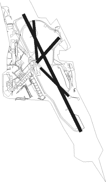
Runway info
Runway 16 / 34  | ||
| length | 1951m (6401ft) | |
| bearing | 144° / 324° | |
| width | 46m (151ft) | |
| surface | asphalt | |
| blast zone | 10m (33ft) / 0m (0ft) | |
| Runway 14 / 32 | ||
| length | 579m (1900ft) | |
| bearing | 122° / 302° | |
| width | 36m (118ft) | |
| surface | asphalt | |
| Runway 05 / 23 | ||
| length | 474m (1555ft) | |
| bearing | 63° / 243° | |
| width | 46m (151ft) | |
| surface | concrete | |
| Runway 18 / 36 | ||
| length | 569m (1867ft) | |
| bearing | 178° / 358° | |
| width | 35m (115ft) | |
| surface | asphalt | |
Nearby beacons
| code | identifier | dist | bearing | frequency |
|---|---|---|---|---|
| ADN | ABERDEEN VOR/DME | 6.8 | 327° | 114.30 |
| ATF | DYCE (ABERDEEN) NDB | 8 | 144° | 348 |
| DND | DUNDEE NDB | 54 | 231° | 394 |
| LUK | LEUCHARS TACAN | 54.4 | 219° | 110.50 |
Departure and arrival routes
| Transition altitude | 6000ft |
| SID end points | distance | outbound heading | |
|---|---|---|---|
| RW16 | |||
| PTH | 60mi | 237° | |
| RW34 | |||
| PTH | 60mi | 237° | |
Disclaimer
The information on this website is not for real aviation. Use this data with the X-Plane flight simulator only! Data taken with kind consent from X-Plane 12 source code and data files. Content is subject to change without notice.