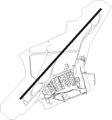
Glasgow
Airport details
| Country | United Kingdom |
| State | Scotland |
| Region | EG |
| Airspace | Scottish Ctr |
| Municipality | Renfrewshire |
| Elevation | 20ft (6m) |
| Timezone | GMT +0 |
| Coordinates | 55.87107, -4.42571 |
| Magnetic var | |
| Type | land |
| Available since | X-Plane v10.40 |
| ICAO code | EGPF |
| IATA code | GLA |
| FAA code | n/a |
Communication
| Glasgow Glasgow Information | 129.575 |
| Glasgow Glasgow Ground | 121.705 |
| Glasgow Glasgow Tower | 118.805 |
| Glasgow Glasgow Approach | 119.100 |
Approach frequencies
| ILS-cat-III | RW23 | 110.1 | 18.00mi |
| ILS-cat-III | RW05 | 110.1 | 18.00mi |
| 3° GS | RW23 | 110.1 | 18.00mi |
| 3° GS | RW05 | 110.1 | 18.00mi |
Nearby Points of Interest:
Argyll Stone and St Conval's Chariot
-Renfrew, The Cross, Renfrew Town Hall
-Paisley War Memorial
-Coats Observatory
-George A. Clark Town Hall
-Paisley, Oakshaw Road, John Neilson Institution
-Paisley, Bridge Street, Abbey Bridge
-Russell Institute
-Ferry Inn, Clyde Street, Renfrew
-St Matthew's Church
-Clydebank, 49 Dumbarton Road, Municipal Buildings
-Luma Tower
-2141 Paisley Road West, Cardonald Parish Church
-Pollok, 510 Crookston Road, Leverndale Hospital
-Fossil Grove
-Stanely Castle
-1a Drumoyne Drive, Elder Cottage Hospital
-Elder Park, Statue of Mrs John Elder
-Blantyre Monument
-Anniesland Court
-Gartnavel Royal Hospital
-The Pearce Institute
-816-818 Govan Road, British Linen Bank
-Cochno Stone
-Burgh Hall Street, Burgh Hall
Nearby beacons
| code | identifier | dist | bearing | frequency |
|---|---|---|---|---|
| GLW | GLASGOW NDB | 0.2 | 261° | 331 |
| GOW | GLASGOW VOR/DME | 0.6 | 268° | 115.40 |
| DUD | DME | 19.6 | 209° | 115.45 |
| PIK | PRESTWICK NDB | 22.5 | 203° | 355 |
| UW | EDINBURGH NDB | 31.1 | 88° | 368 |
| TRN | TURNBERRY VOR/DME | 35.6 | 213° | 117.50 |
| GLO | LOWTHER DME | 37.1 | 125° | 109.65 |
| OBA | DME-ILS | 48.1 | 301° | 110.55 |
| OBN | OBAN NDB | 48.1 | 301° | 404 |
Departure and arrival routes
| Transition altitude | 6000ft |
| SID end points | distance | outbound heading | |
|---|---|---|---|
| RW05 | |||
| FOYL3B | 16mi | 9° | |
| PTH4B | 49mi | 62° | |
| TLA6B | 43mi | 109° | |
| LUSI1B | 14mi | 138° | |
| TRN6B | 36mi | 213° | |
| NORB1J | 20mi | 231° | |
| ROBO2B | 16mi | 272° | |
| CLYD3B | 14mi | 284° | |
| LOMO3B | 13mi | 321° | |
| RW23 | |||
| FOYL3A | 16mi | 9° | |
| PTH4A | 49mi | 62° | |
| TLA5A | 43mi | 109° | |
| LUSI1A | 14mi | 138° | |
| TRN3A | 36mi | 213° | |
| NORB1H | 20mi | 231° | |
| ROBO2A | 16mi | 272° | |
| CLYD3A | 14mi | 284° | |
| LOMO3A | 13mi | 321° | |
| STAR starting points | distance | inbound heading | |
|---|---|---|---|
| ALL | |||
| BLAC1G | 64.3 | 37° | |
| BRUC1G | 52.2 | 104° | |
| ERSO1G | 35.7 | 191° | |
| PTH1G | 49.2 | 242° | |
| AGPE1G | 95.5 | 287° | |
| APLE1G | 105.2 | 306° | |
| RIBE1G | 133.5 | 311° | |
Holding patterns
| STAR name | hold at | type | turn | heading* | altitude | leg | speed limit |
|---|---|---|---|---|---|---|---|
| AGPE1G | LANAK | VHF | right | 123 (303)° | 7000ft - 14000ft | DME 4.0mi | 230 |
| APLE1G | LANAK | VHF | right | 123 (303)° | 7000ft - 14000ft | DME 4.0mi | 230 |
| BLAC1G | LANAK | VHF | right | 123 (303)° | 7000ft - 14000ft | DME 4.0mi | 230 |
| BRUC1G | FYNER | VHF | left | 297 (117)° | 7000ft - 14000ft | 1.0min timed | 230 |
| ERSO1G | FOYLE | VHF | left | 9 (189)° | 7000ft - 14000ft | 1.0min timed | 230 |
| PTH1G | STIRA | VHF | right | 54 (234)° | 7000ft - 14000ft | DME 4.0mi | 230 |
| RIBE1G | LANAK | VHF | right | 123 (303)° | 7000ft - 14000ft | DME 4.0mi | 230 |
| *) magnetic outbound (inbound) holding course | |||||||
Disclaimer
The information on this website is not for real aviation. Use this data with the X-Plane flight simulator only! Data taken with kind consent from X-Plane 12 source code and data files. Content is subject to change without notice.