Cumbernauld
Airport details
| Country | United Kingdom |
| State | Scotland |
| Region | EG |
| Airspace | Scottish Ctr |
| Municipality | North Lanarkshire |
| Elevation | 349ft (106m) |
| Timezone | GMT +0 |
| Coordinates | 55.97472, -3.97556 |
| Magnetic var | |
| Type | land |
| Available since | X-Plane v10.32 |
| ICAO code | EGPG |
| IATA code | n/a |
| FAA code | n/a |
Communication
| Cumbernauld Cumbernauld Radio | 120.600 |
Nearby Points of Interest:
Castle Cary Castle
-Cumbernauld College campus
-Garrel Mill
-Kilsyth, Garrel Mill House
-48–50 Market Street, Kilsyth
-Kilsyth Parish Church
-Antonine Wall
-Carron Bridge
-Rough Castle Fort
-Howietoun Fish Farm
-Auld Aisle Cemetery
-Sir John de Graham’s Castle
-Airdrie, 8 Bank Street, Town Clerk's Office
-Kirkintilloch Town Hall
-Bannockburn House
-Old Parish Church of St. Mary
-Airdrie, Stirling Street, Sir John Wilson Town Hall
-Coatbridge, Dunbeth Road, Municipal Buildings
-Coatbridge Library
-Bannockburn, Rotunda, Memorial Cairn, Flagpole And Statue Of King Robert I
-Falkirk, Callendar Park, Callendar House, Mausoleum
-Fintry Castle
-Stirling, 8-10 Corn Exchange Road, Municipal Buildings
-Stirling, 65-67 King Street, Burgh Buildings
-Stirling, Academy Road, High School
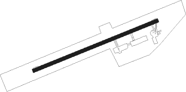
Runway info
| Runway 08 / 26 | ||
| length | 817m (2680ft) | |
| bearing | 80° / 260° | |
| width | 23m (75ft) | |
| surface | asphalt | |
Nearby beacons
| code | identifier | dist | bearing | frequency |
|---|---|---|---|---|
| UW | EDINBURGH NDB | 16.4 | 98° | 368 |
| GLW | GLASGOW NDB | 16.6 | 257° | 331 |
| GOW | GLASGOW VOR/DME | 17 | 258° | 115.40 |
| EDN | EDINBURGH NDB | 23.1 | 90° | 341 |
| DUD | DME | 32.7 | 236° | 115.45 |
| PTH | PERTH VOR | 34.6 | 52° | 110.40 |
| PIK | PRESTWICK NDB | 34.7 | 232° | 355 |
| TLA | TALLA VOR/DME | 35.4 | 127° | 113.80 |
| GLO | LOWTHER DME | 36 | 158° | 109.65 |
| DND | DUNDEE NDB | 40.7 | 61° | 394 |
| TRN | TURNBERRY VOR/DME | 48.2 | 231° | 117.50 |
Disclaimer
The information on this website is not for real aviation. Use this data with the X-Plane flight simulator only! Data taken with kind consent from X-Plane 12 source code and data files. Content is subject to change without notice.